

McMaster University Library is fortunate to possess a rich collection of rare, antique maps. The oldest map in the collection was published in Johannes Reger's 1486 edition of Ptolemy's Cosmographia. Original maps may be viewed in the Library's Archives & Research Collections Division.
Search using our Rare Map Database
Browse the entire collection in alphabetical order by title
View an explanation of the citation style used in our Rare Map Database descriptions
View an explanation of the units of measure and map scales appearing on the maps in our Rare Map Collection
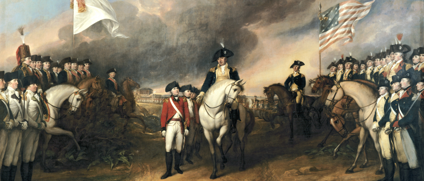
View the map used for the Rare Map Collection web page banner.
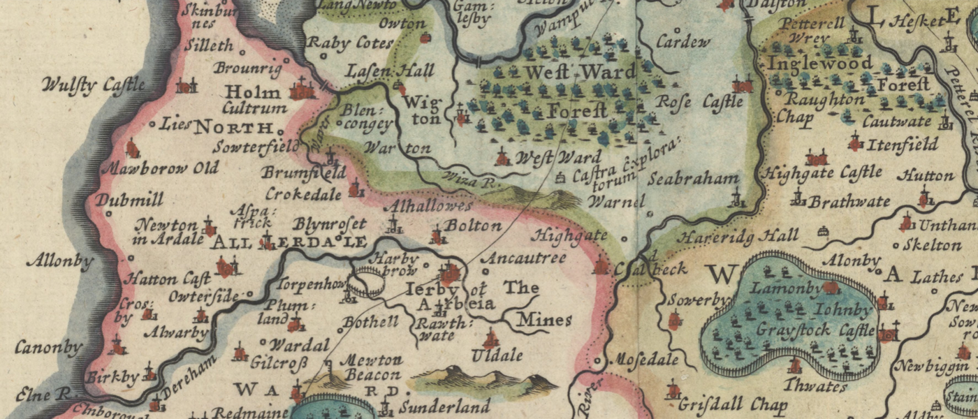
This collection consists of the historical county maps of Great Britain & Ireland by the famous geographers and map publishers: Christopher Saxton, John Speed, Joan Blaeu, Robert Morden, Herman Moll, Richard Blome, John Cary, Thomas Jefferys, John Rocque, Thomas Kitchin, Emanuel Bowen, and more...
View the County Map Collection
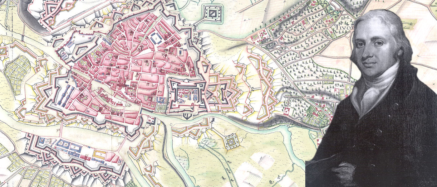
Clifford’s maps reveal a world on the cusp of an evolutionary shift in cartography brought about by the Napoleonic wars. Hand-coloured, manuscript maps depicting the precise and exacting geometry of Vauban-designed fortified cities exist within the collection side-by-side with maps printed from engraved plates, incorporating new techniques and symbology to satisfy the shifting focus onto the surrounding landscape of unordered nature. They are simultaneously works of art, tools of science, and records of history.
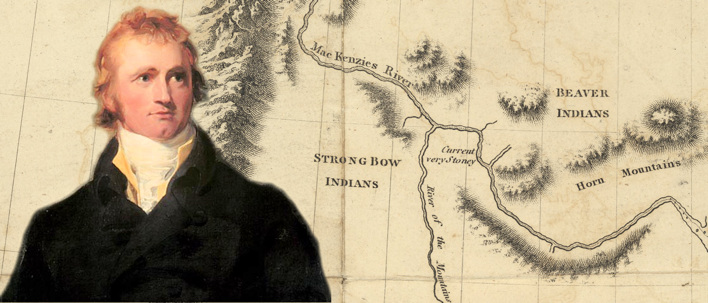
The maps of Jacques Cartier, Samuel de Champlain, Baron de Lahontan, Alexander Mackenzie, Peter Pond, Captains James Cook , John Franklin, George Back, and more...
Maps of the expedition from Canada of General Burgoyne, as well as the attack of the rebels on Fort Penobscot.
A sketch of the Battle at Christlers Farm, Williamsburg, Upper Canada, 11th November 1813.
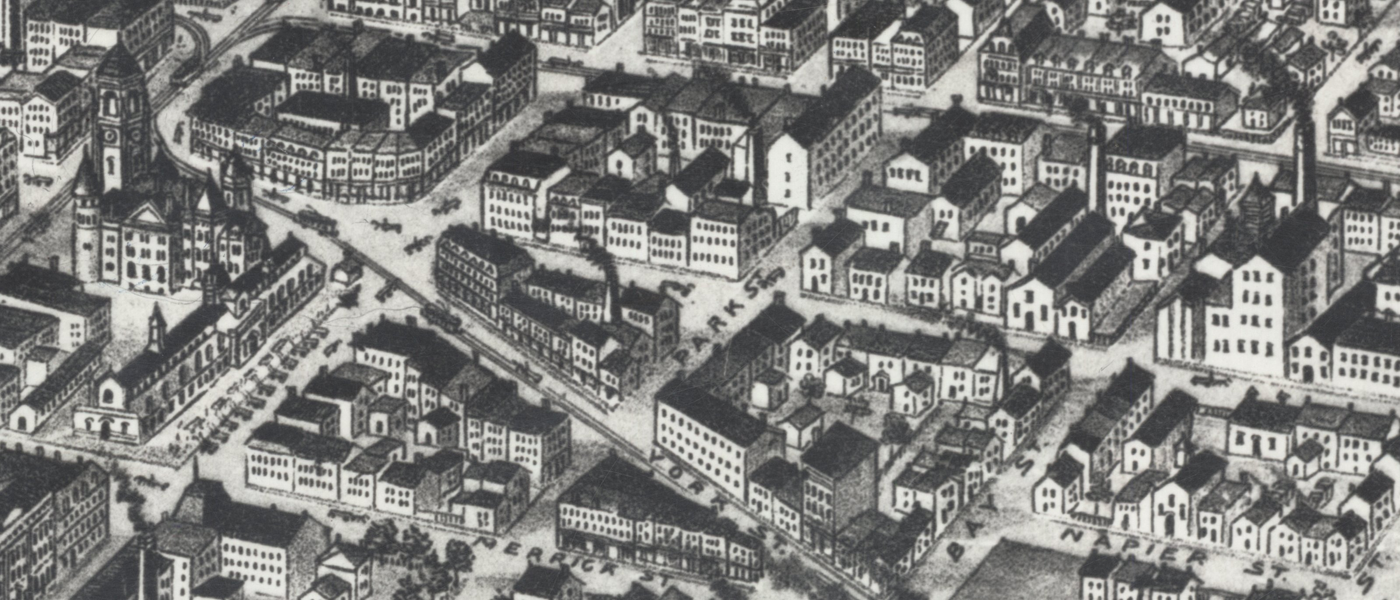
View a wide variety of historical maps and text-based resources for research of the local Hamilton area, ranging from 19th century Bird's-Eye view maps and survey plans, to city directories dating back to the year 1853.
View the 19th Century Survey Plans
View the entire Collection of Hamilton Area Historical Research Resources
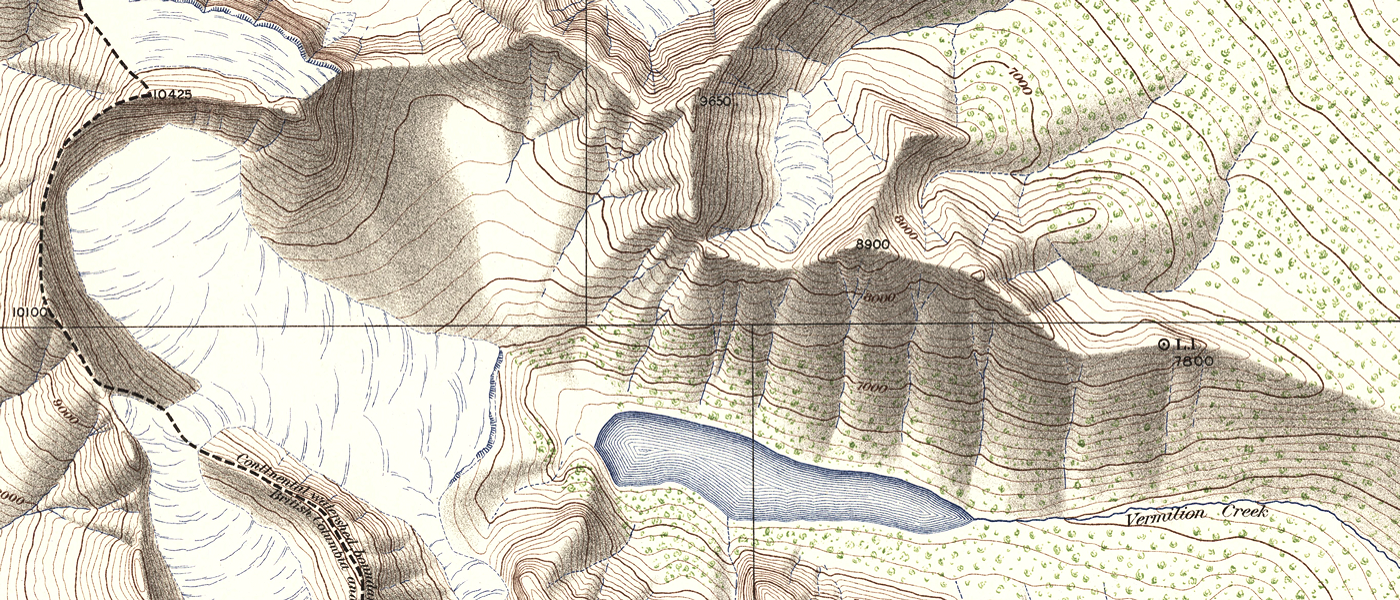
The first photo-topographic survey in Canada was undertaken by James Joseph McArthur in the Rocky Mountains in 1887. Surveyors like McArthur, A. O. Wheeler, and M. P. Bridgland would go on to found the Canadian Alpine Club while mapping over 34,000 square miles between 1887 and 1923, making Canada the international leader in photo-topography.
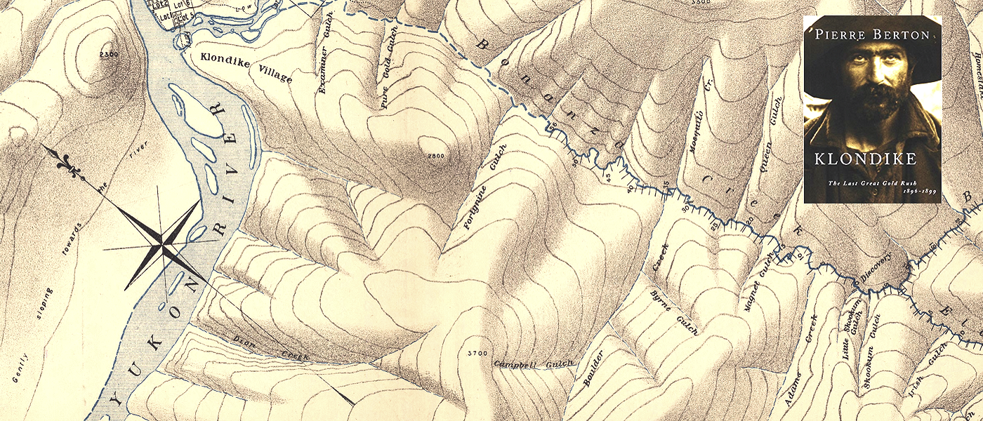
The discovery of gold in the Yukon in 1896 led to a stampede to the Klondike region between 1897 and 1899. This led to the establishment of Dawson City in 1896, and subsequently, the Yukon Territory in 1898. Under orders from the Canadian Border Commission, W.F. King surveyed 5,000 square miles along the Alaska-B.C. boundary using photo-topographic survey methods In 1893 and 1894. In 1887 William Ogilvie was authorized by Ottawa to head an expedition to locate as definitely as possible the 141st meridian on the Yukon River. This action heralded the first direct attempt to fix with precision the Canada-United State boundary line in that part of North America. The gold rush brought to a head the ongoing border dispute in the contested Alaskan Panhandle area prompting several surveys, including the Yukon Map of 1898 on 10 sheets.
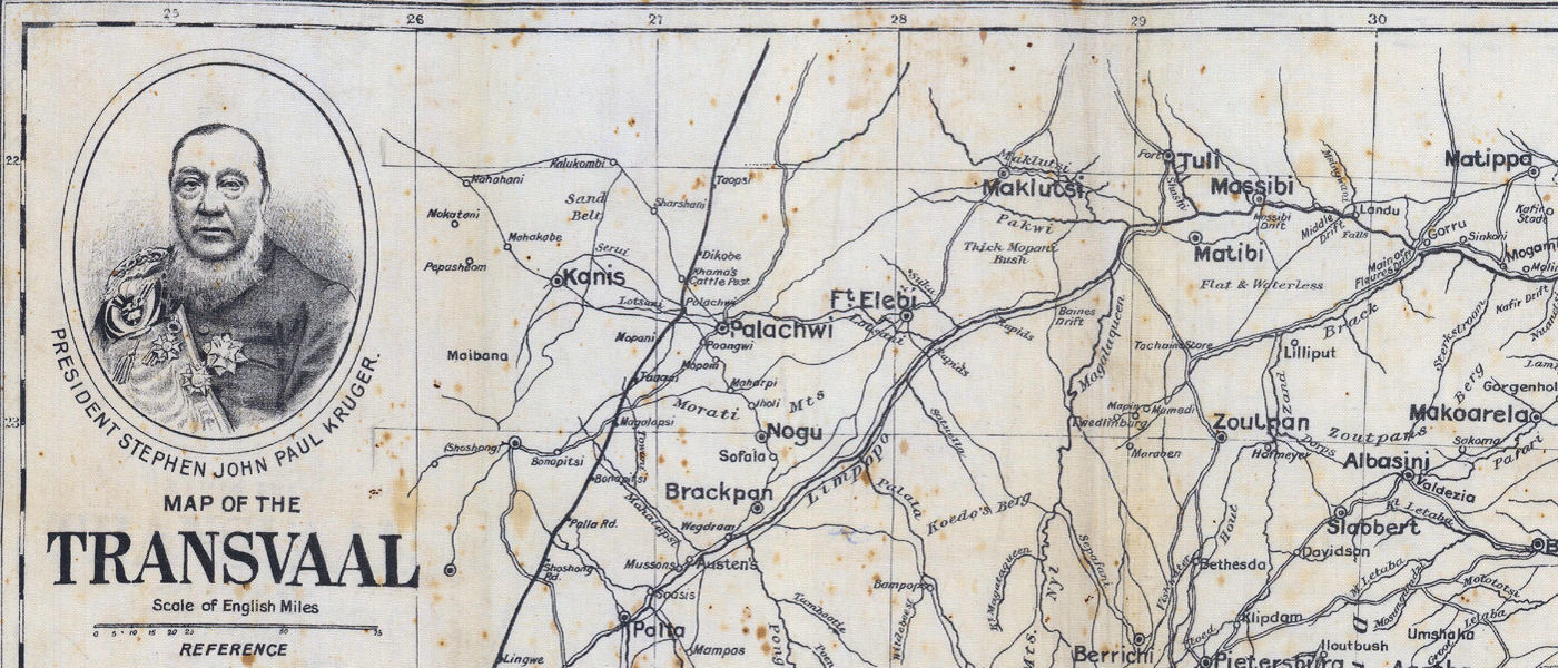
The South African War (1899–1902) was Canada's first foreign war. Also known as the Boer War, it was fought between Britain (with help from its colonies and Dominions such as Canada) and the Afrikaner republics of Transvaal and the Orange Free State. Although only 270 Canadians died in South Africa, the war was significant because it marked the first time Canadian troops distinguished themselves in battle overseas. At home, it fuelled a sense that Canada could stand apart from the British Empire, and it highlighted the French-English divide over Canada's role in world affairs — two factors that would soon appear again in the First World War.--The Canadian Encyclopedia
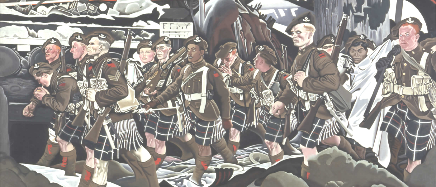
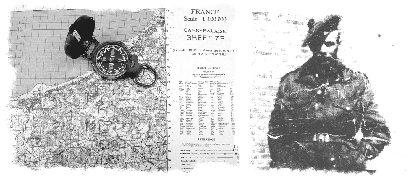
Most of the maps in this collection were produced by the British Ordnance Survey for the Allied forces, although a few German, French and other maps purchased privately by officers exist within the collection. They range in scale from very detailed operations maps used for trench raids to very broad overview maps used to show the entire front. The majority of the collection is made up of 1:10,000 scale trench maps, 1:20,000 scale artillery maps, and 1:40,000 scale officer's planning maps. The bulk of the collection is from the latter part of the war in the years 1917 and 1918 when map production had increased dramatically. Many are of the Canadian sector of the front during the so-called "Last Hundred Days" of the war (August 1918 - November 1918) with some produced by the Canadian Corps topo section.
Aerial photograph coverage is scattered over much of the area of conflict in France and Belgium but there is a high concentration of photography in areas around Ypres, Meteren, Messines, Lille and Wytschaete with some coverage around areas such as Albert, Cambrai, the Hindenburg line, Canal du Nord and Cuinchy brick stacks.
Search the WWI Trench Map and Aerial Photo Collection
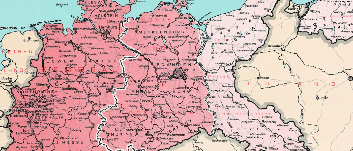
The almost 10,000 topographic maps in this collection were produced by the British War Office, Geographical Section, General Staff (G.S.G.S.) and the U.S. Army Map Service (A.M.S.) during the war years of 1939-1945. They cover most of Europe at multiple scales. Although most do not contain military annotations, they provide a rich topographical database of information which can aid the researcher to comprehend puzzling aspects of terrain or to locate vanished villages, road networks and landmarks. They should be of particular interest to historians and genealogists but can also be used by anyone interested in obtaining a visual accompaniment to related texts, documents and records. They represent a valuable primary source of information which can be utilized to support research with many of McMaster's unique archives such as our Holocaust and Resistance Collection.
Maps and gazetteers of Soviet occupied Afghanistan, a divided East and West Germany, Canadian Military Town Plans and more...
The maps in this collection were produced by the U.S. Army Map Service (A.M.S.) with some sheets published in cooperation with the Republic of Korea Army Map Service (ROKA) between the years 1945-1955. Most of the sheets are dated between the war years of 1950-1953. Our collection consists of 160 map sheets from the set of nearly 700. Most fall within South Korea and some have more than one edition, bringing the total number of maps in the collection to almost 200. Some maps are monochrome with Sino-Korean characters while later editions tend to be in colour with text in English and place names in romanized letters.
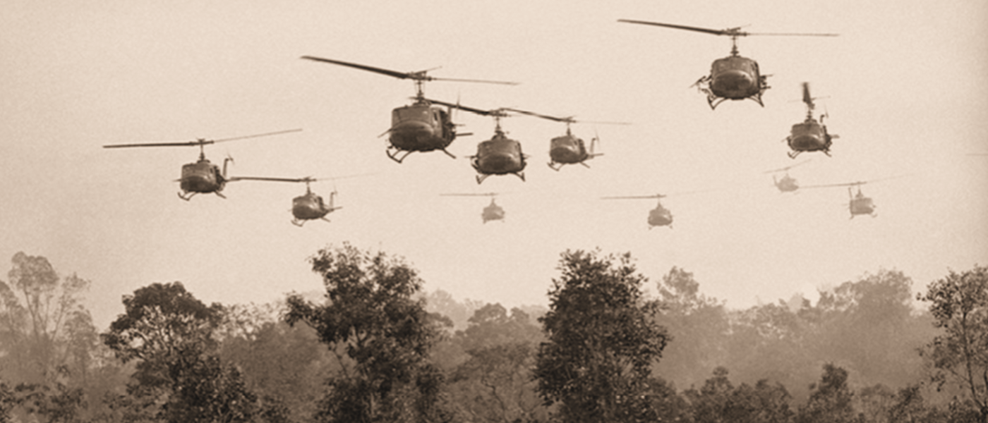
The Vietnam War map collection consists of a set of topographic maps covering the country at a scale of 1:500,000, as well as very detailed maps of cities like Saigon and Hanoi at scales between 1:12,500 and 1:15,000.
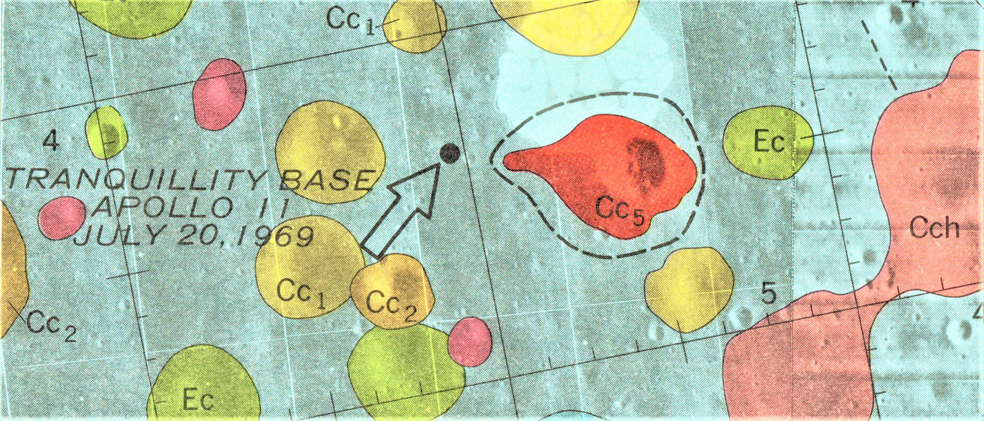
This collection of charts consists of the original mapping prepared by NASA, the USGS, and the USAF Aeronautical Chart and Information Center for the Apollo missions (1962-1976), including "landing site" and "pre-mission maps." It also includes Mars and other planetary mapping.
"The October Crisis began on the 5th of October, 1970 with the kidnapping of James Cross, the British trade commissioner in Montréal, by members of the Front de Libération du Québec (FLQ). It rapidly devolved into the most serious terrorist act carried out on Canadian soil after another official, Minister of Immigration and Minister of Labour Pierre Laporte, was kidnapped and killed. The crisis shook the career of recently elected Liberal Premier Robert Bourassa, who solicited federal help along with Montréal Mayor Jean Drapeau. This help would lead to the only invocation of the War Measures Act during peacetime in Canadian history."--The Canadian Encyclopedia
In response to the crisis, the Mapping and Charting Establishment of the Department of National Defence was ordered to rapidly update many of the map sheets in the Canadian National Topographic Series covering the Province of Quebec.
Coming soon!
View a sample of georeferenced historical maps and air photos from McMaster University Library’s Lloyd Reeds Map Collection. Users can export the images in a variety of formats for use in Geographic Information Systems (GIS) software. The complete collection of digitized maps and air photos can be found in McMaster Library’s Digital Archive and have been made available for non-commercial purposes through a Creative Commons Attribution-NonCommercial license.