Cold War Mapping
Permitted Use of the Maps: McMaster University Library is providing digital access to these maps and charts and the ability to download high resoultion copies (600 dpi, 1GB, .TIF) for non-commercial purposes only. For allowable use of the images found on this website, see the Creative Commons License.
Afghanistan
Afghanistan (Soviet Occupation, 1979-1989)
Historical and Political Gazetteer of Afghanistan in 6 Volumes
(This edition includes the formerly secret Gazetteer of Afghanistan (compiled in 1914) with corrections and additions of maps and new material to take into account developments up to 1970).
Apollo Missions and Planetary Mapping
Canadian Military Town Plans and E.M.O. Maps
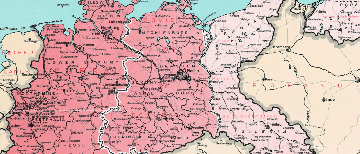
Germany (East & West)
Korean War Topographic Maps
Vietnam War Topographic and City Maps
Soviet Topographic Map of the Toronto Area (1981)
U.S. Navy Air Navigation Charts coming soon...
You may also be interested in...
The U.S. National Archives digitized collection of cold war mapping
Note: the materials listed below are available in paper format only in the Lloyd Reeds Map Collection.
The Red Atlas: How the Soviet Union Secretly Mapped the World (2017)