Geospatial Data
| Title Sort descending | Author | Year | Sample |
|---|---|---|---|
| Bear Management Area | Ontario Ministry of Natural Resources | 1997 - 2013 | 
|
| Cadastral Location | Ontario Ministry of Natural Resources | 2009 | 
|
| Camp, Recreation | Ontario Ministry of Natural Resources | 1997 - 2006 | 
|
| City of Calgary's Open Data Portal | The City of Calgary |
Current | |
| City of Vancouver Open Data Portal | City of Vancouver |
Varies by dataset | 
|
| Crown Game Preserves | Ontario Ministry of Natural Resources | 1998 | 
|
| Crown Land Use Policy Atlas (CLUPA) - Replaced | Ontario Ministry of Natural Resources | 2004 - 2013 | 
|
| Crown Leased Land - Replaced | Ontario Ministry of Natural Resources | 1998 - 2012 | 
|
| DataMB | Government of Manitoba | Varies by dataset | |
| Emergency Management Historical Events | Ontario Ministry of Natural Resources | 2010 | 
|
| Federal Land Other | Ontario Ministry of Natural Resources | 2011 | 
|
| Federal Protected Area | Ontario Ministry of Natural Resources | 2008 | 
|
| Floodplain Hazard Land Mapping - Ontario | Ontario Ministry of Natural Resources | 1972 - 1991 | 
|
| Geographic Named Extent | Ontario Ministry of Natural Resources | 1500 - 2011 | 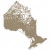
|
| Hamilton Parcel/Land Use Data | Teranet Inc. and The City of Hamilton, Dept. of Planning and Economic Development. |
Varies, between 2009 and 2020 | 
|
| Land Cover Region | DMTI Spatial Inc. | 2015 - 2023 | 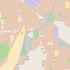
|
| Land Feature Labels (LLP) | DMTI Spatial Inc. | 2001 - 2014 | 
|
| Land Ownership - Replaced | Ontario Ministry of Natural Resources | 1977 - 2012 | 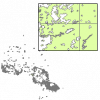
|
| Land Use (LUR) | DMTI Spatial Inc. | 2001 - 2014 | 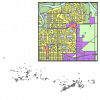
|
| Land Use Plan Area, MNR | Ontario Ministry of Natural Resources | 2006 | 
|
