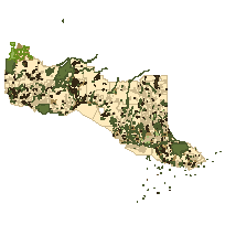
The Crown Land Use Policy Atlas (CLUPA) consists of the principal/primary land use direction and geographic extent for Crown Land, and, to be used in conjunction with, the overlay land use designations that provide supplementary direction that modifies part of the primary land use policy for the Province of Ontario.
CLUPA Primary Land Use Area - REPLACED
This layer may contain geometry from the following layers:
Please refer to the Crown Land Use Policy Atlas website for authoritative information.
Retirement note: This layer has been replaced by CLUPA Provincial.
CLUPA Modifying Land Use Area - REPLACED
Contains overlay land use designations that provide supplementary direction that modifies part of the primary land use policy for the Province of Ontario. These overlay or modifying policies are intended be read in conjunction with the primary designation and are not stand alone reporting documents.
Please refer to the Crown Land Use Policy Atlas website for authoritative information.
Retirement note: This layer has been replaced by CLUPA Overlay.
Access this resource on Scholars Geoportal.
Access this resource on Scholars Geoportal.