This data set includes information from Canada's Flood Damage Reduction Program (FDRP). In addition to FDRP features, this data set also includes some First Nations floodplain mapping. It does not include any Conservation Authority floodplain mapping.
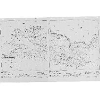
Floodplain Hazard Land Mapping - Ontario contains both raster and vector data. The raster data is a collection of geo-referenced maps, and the vector data is floodplain information digitized from the hard copy maps.
Please note that this data set has not been updated since 1991. Also, the raster data contains varying high and low values. Please use caution when interpreting data and results.
To obtain the raster data, please download Parts 1- 4. To obtain the vector data, please download Part 5.
Access this resource on Scholars Geoportal.
Access this resource on Scholars Geoportal.