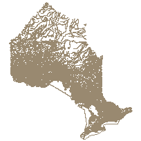
This data set can be used to identify the extents/ boundaries of geographic features and unincorporated places that have been officially named or which are being considered for official naming. This data set also contains geographical referencing information (type of feature or place, location coordinates, geographic township, municipal and map references) about these features and places and background information behind their official naming (name status, naming date, name origin, naming history, etc).
Please note that all Geographic Name Extents have yet to be defined and that alignment of the Geographic Name Extent layer with other hydrographic layers is on going.
Supplementary tables (including a look-up table) can be used and are available for download from the additional documentation section. Supplementary look-up table descriptions are available in the data description document, which is available for download from the additional documentation section. This layer is part of what was known as the OMNR Non-Fundamental Dataset.
Access this resource on Scholars Geoportal.
Access this resource on Scholars Geoportal.
