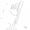
| Industrial and Resource - Lines (IRL) |
DMTI Spatial Inc. |
2001 - 2014 |
|
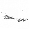
| Industrial and Resource - Points (IRP) |
DMTI Spatial Inc. |
2001 - 2014 |
|
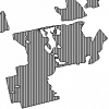
| Industrial and Resource - Regions (IRR) |
DMTI Spatial Inc. |
2001 - 2014 |
|
| Intermittent Water (MNINR) |
DMTI Spatial Inc. |
2005 - 2014 |

|
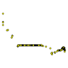
| International Road Linkages Point |
DMTI Spatial Inc. |
2015 - 2023 |
|
| Issum, Germany. 1:25,000. Map Sheet 4404, 2nd Edition, Defence Overprint, 18 December 1944, Version 1 |
Great Britain. War Office. General Staff. Geographical Section. |
1944 |

|
| Issum, Germany. 1:25,000. Map Sheet 4404, 2nd Edition, Defence Overprint, 18 December 1944, Version 2 |
Great Britain. War Office. General Staff. Geographical Section. |
1944 |

|
| Issum, Germany. 1:25,000. Map Sheet 4404, 3rd Edition, Defence Overprint, 6 February 1945, Version 1 |
Great Britain. War Office. General Staff. Geographical Section. |
1945 |

|
| Issum, Germany. 1:25,000. Map Sheet 4404, 3rd Edition, Defence Overprint, 6 February 1945, Version 2 |
Great Britain. War Office. General Staff. Geographical Section. |
1945 |

|
| Issum, Germany. 1:25,000. Map Sheet 4404, 3rd Edition, Going Map, 12 October 1944 |
Great Britain. War Office. General Staff. Geographical Section. |
1944 |

|
| Japan Tsunami Affected Area - March 2011 |
East View Cartographic |
2011 |
|
| Kempen, Germany. 1:25,000. Map Sheet 4604, Going Map, 28 September 1944 |
Great Britain. War Office. General Staff. Geographical Section. |
1944 |

|
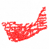
| Kingston Civic Addresses |
City of Kingston |
2021 |
|
| Kingston Road Segments |
City of Kingston |
2021 |

|
| Koudekerke-Vlissingen and Oostsouburg, Holland. 1:10,000. Map Sheet 2, 1st Edition, Defence Overprint, 28 October 1944 |
Canada. Royal Canadian Engineers |
1944 |

|
| Krannenburg, Germany. 1:12,500. Map Sheet 4202/1, 1st Edition, Defence Overprint, 17 January 1945 |
Canada. Royal Canadian Engineers |
1945 |

|
| Krannenburg, Germany. 1:12,500. Map Sheet 4202/1, 1st Edition, Defence Overprint, 2 February 1945 |
Canada. Royal Canadian Engineers |
1945 |

|
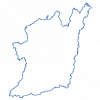
| Lake Simcoe Protection Act Watershed Boundary |
Ontario Ministry of Environment |
2009 |
|
| Land and Water Digital Map Series 34: Global Map of Irrigation Areas |
United Nations. Food and Agricultural Administration (FAO) |
2013 |
|
| Land Cover Region |
DMTI Spatial Inc. |
2015 - 2023 |
|