Geospatial Data
| Title Sort descending | Author | Year | Sample |
|---|---|---|---|
| Staging Area, Wildlife | Ontario Ministry of Natural Resources | 1998 - 2005 | 
|
| Standard Time Zones (TZS) | DMTI Spatial Inc. | 2001 - 2014 | 
|
| Stationary Cranes Point | DMTI Spatial Inc. | 2015 - 2023 | 
|
| Stewardship Council Area | Ontario Ministry of Natural Resources | 2010 - 2013 | 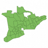
|
| Stewardship Council Location | Ontario Ministry of Natural Resources | 2010 - 2013 | 
|
| Stewardship Zone | Ontario Ministry of Natural Resources | 2010 - 2013 | 
|
| Stockyard Region | DMTI Spatial Inc. | 2015 - 2023 | 
|
| Street Network File (SNF), 1986 Census | Statistics Canada | 1988 | 
|
| Street Network Files (SNF), 1991 Census | Statistics Canada | 1992 | 
|
| Street Network Files (SNF), 1996 Census | Statistics Canada | 1997 | 
|
| Subdivision de recensement - Fichiers numériques des limites (SDR) (Intercensitaires) | Statistique Canada | 2008 - 2022 | |
| Surficial Geology of Southern Ontario - Line Representation | Ontario Ministry of Northern Development, Mines and Forestry | 2003 - 2010 | 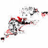
|
| Surficial Geology of Southern Ontario - Miscellaneous | Ontario Ministry of Northern Development, Mines and Forestry | 2003 - 2010 | 
|
| Surficial Geology of Southern Ontario - Moraines | Ontario Ministry of Northern Development, Mines and Forestry | 2003 - 2010 | 
|
| Surficial Geology of Southern Ontario - Point Representation | Ontario Ministry of Northern Development, Mines and Forestry | 2003 - 2010 | 
|
| Surficial Geology of Southern Ontario - Polygon Representation | Ontario Ministry of Northern Development, Mines and Forestry | 2003 - 2010 | 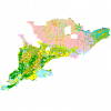
|
| Surficial Materials of Canada Map - 1880A | Natural Resources Canada |
1995 | 
|
| Tactical Pilotage Charts (TPC) | LAND INFO Worldwide Mapping, LLC |
1989 | |
| Tank | Ontario Ministry of Natural Resources | 1977 - 2007 | 
|
| Tank Point | DMTI Spatial Inc. | 2015 - 2023 | 
|
