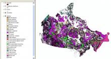
This data consists of geology, landforms, and hydrography on separate layers in .DXF, .MIF, or .E00 formats. This data corresponds to the published maps that were used in the compilation of Map 1880A. The map shows the distribution of surficial materials in Canada, on land and in extensive offshore areas, at 1:5,000,000 scale. It portrays broad genetic categories of surface materials (alluvial, lacustrine, marine, glacial) and bedrock. The map was compiled using information from the Geological Survey of Canada, provincial geological surveys, and other sources. It provides a generalized picture of surface materials for the entire country which serves as base information for a variety of applications.
Available for download through GEOSCAN.
