Geospatial Data
| Title Sort descending | Author | Year | Sample |
|---|---|---|---|
| 1934 Air Photos of Niagara Region | Canada Department of Energy, Mines, and Resources | 1934 - 2017 | 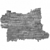
|
| 2020 Land Cover of Canada | CCRS, CCMEO, NRCAN | 2022-2024 | |
| Aboriginal Boundaries Bands Table | DMTI Spatial Inc. | 2018 - 2023 | |
| Aboriginal Boundaries Region | DMTI Spatial Inc. | 2015 - 2023 | 
|
| Aboriginal Lands of Canada Legislative Boundaries | Natural Resources Canada | 2017 | 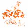
|
| Accommodations Point | DMTI Spatial Inc. | 2015 - 2023 | 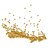
|
| Address Delta Point | DMTI Spatial Inc. | 2017 - 2023 | 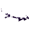
|
| Administrative Area Region | DMTI Spatial Inc. | 2015 - 2023 | 
|
| Administrative Boundary Lines - Provincial and Territory | DMTI Spatial Inc. | 2015 - 2023 | 
|
| Aerial Cableway Line | DMTI Spatial Inc. | 2015 - 2023 | 
|
| Aerodromes (AER) | DMTI Spatial Inc. | 2002 - 2014 | 
|
| Air Transport Point | DMTI Spatial Inc. | 2015 - 2023 | 
|
| Alternate Street Types (alt_types) | DMTI Spatial Inc. | 2012 - 2014 | |
| Antennas And Frequencies Point | DMTI Spatial Inc. | 2015 - 2023 | 
|
| Arctic Spatial Data Infrastructure | Operated by National Land Survey of Finland in the Arctic SDI cloud environment hosted by the Norwegian Mapping Authority. Contributions by National Mapping Agencies and other partners and affiliates. | ||
| Area Code Boundaries (ACB) | DMTI Spatial Inc. | 2001 - 2014 | 
|
| Arenas Point | DMTI Spatial Inc. | 2015 - 2023 | 
|
| Atiku: The Northern and Arctic Studies Portal | Collaboration between Quebec universities (Concordia, INRS, Laval, McGill, UQÀM) and Bibliothèque et archives nationales du Québec | Various | |
| Atlas of the Biosphere | The Nelson Institute Center for Sustainability and the Global Environment, University of Wisconsin-Madison |
1998 - 2001 | |
| BatchGeo | BatchGeo LLC |
Current |
