Geospatial Data
| Title Sort descending | Author | Year | Sample |
|---|---|---|---|
| UTM 10KM Grid | Ontario Ministry of Natural Resources | 2009 | 
|
| UTM 1KM Grid | Ontario Ministry of Natural Resources | 2011 | 
|
| UTM 5KM Grid | Ontario Ministry of Natural Resources | 2011 | 
|
| Valves Point | DMTI Spatial Inc. | 2015 - 2023 | 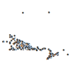
|
| Vector Map Level 0 (VMap0) | LAND INFO Worldwide Mapping, LLC |
2000 | |
| Vegetation (VER) | DMTI Spatial Inc. | 2001 - 2014 | 
|
| Vegetation Index Region | DMTI Spatial Inc. | 2015 - 2023 | 
|
| Versen, Germany. 1:25,000. Map Sheet 4704, Going Map, 1944 | Great Britain. War Office. General Staff. Geographical Section. | 1944 | 
|
| Veterinarians Point | DMTI Spatial Inc. | 2015 - 2023 | 
|
| Vlissingen West, Holland. 1:25,000. Map Sheet 14 SW West, Defence Overprint, Walcheren, 14 September 1944 | United States. Army Map Service | 1944 | 
|
| Voorst, Holland. 1:25,000. Map Sheet 3802, 2nd Edition, Defence Overprint, 19 March 1945 | United States. Army Map Service | 1945 | 
|
| Waldniel, Germany. 1:25,000. Map Sheet 4703, Going Map, 1944 | Great Britain. War Office. General Staff. Geographical Section. | 1944 | 
|
| Waste Disposal Site - Replaced | Ontario Ministry of Natural Resources | 1997 - 2012 | 
|
| Waste Management Attenuation Zone | Ontario Ministry of Natural Resources | 2012 | 
|
| Waste Management Site | Ontario Ministry of Natural Resources | 2012 | 
|
| Wastewater Data and Reports (Environment and Climate Change Canada) | Environment and Climate Change Canada | 2016 - 2018 | |
| Water Area at 1 Million | Ontario Ministry of Natural Resources | 1983 | 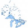
|
| Water Feature Labels (WLP) | DMTI Spatial Inc. | 2001 - 2014 | 
|
| Water Line | DMTI Spatial Inc. | 2015 - 2023 | 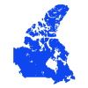
|
| Water Line at 1 Million | Ontario Ministry of Natural Resources | 1983 | 
|
