Geospatial Data
| Title Sort descending | Author | Year | Sample |
|---|---|---|---|
| Movable Cranes Line | DMTI Spatial Inc. | 2015 - 2023 | 
|
| Multiple Enhanced Postal Codes (MEP) | DMTI Spatial Inc. | 2001 - 2014 | 
|
| Municipal Amalgamation File (MAF) | DMTI Spatial Inc. | 2002 - 2014 | 
|
| Municipal at 1 Million | Ontario Ministry of Natural Resources | 1983 | 
|
| Municipal Boundaries (MUN) | DMTI Spatial Inc. | 2001 - 2014 | 
|
| Municipal Boundaries 1996 | Ontario Ministry of Natural Resources | 1996 | 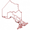
|
| Municipal Boundaries 2005 | Ontario Ministry of Natural Resources | 2005 | 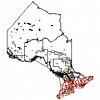
|
| Municipal Boundary - Lower and Single Tier | Ontario Ministry of Natural Resources | 2012 | 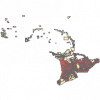
|
| Municipal Boundary - Upper Tier and District | Ontario Ministry of Natural Resources | 2012 | 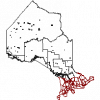
|
| Municipal Open Data Portals in Canada | Data in Ontario (DINO) Open Data Working Group | 2012 - 2014 | 
|
| Municipal Park | Ontario Ministry of Natural Resources | 2000 | 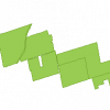
|
| Municipalities Region | DMTI Spatial Inc. | 2015 - 2023 | 
|
| Named Water Features Line | DMTI Spatial Inc. | 2015 - 2023 | 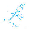
|
| Named Water Features Point | DMTI Spatial Inc. | 2015 - 2023 | 
|
| Named Water Features Region | DMTI Spatial Inc. | 2015 - 2023 | 
|
| National Broadband Data | Innovation, Science, and Economic Development Canada | 2012 | |
| National Hydrology Network | 1970-2022 | ||
| National Pollutant Release Inventory (NPRI) - Reporting Facilities | Environment and Climate Change Canada |
1993 to Present | |
| National Topographic Database System (NTS) - 50 Grid | Ontario Ministry of Natural Resources | 2000 | 
|
| National Topographic System Index (NTS) - 250 Grid | Ontario Ministry of Natural Resources | 2000 | 
|
