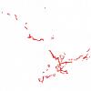
| Ontario Road Network Segment With Address (ORN) |
Ontario Ministry of Natural Resources |
2010 - 2012 |

|
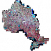
| Ontario SPOT Pansharpened Orthoimagery 2005-2010 |
Ontario Ministry of Natural Resources |
2005 - 2010 |
|
| Ontario Toponymic Database (OTDB) |
Ontario Ministry of Natural Resources |
1500 - 2007 |
|
| Ontario Trail Network |
Ontario Ministry of Natural Resources |
2008 - 2010 |
|
| Ontario Treaties Map |
Ministry of Indigenous Relations and Reconciliation |
2014 |

|
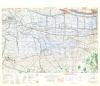
| Oosterhout, Holland. 1:25,000. Map Sheet 10 SW, Emergency Printing, Defence Overprint, 20 January 1945 |
United States. Army Map Service |
1945 |
|
| Open Hamilton |
City of Hamilton |
Varies by dataset |
|
| Open Ottawa (The City of Ottawa's Open Data Catalogue) |
City of Ottawa |
Varies by dataset |
|
| OpenStreetMap - Geofabrik Download Server |
Various |
2018 - 2024 |
|
| Orthoimages of Canada 1999-2003 |
Natural Resources Canada |
1999 - 2003 |
|
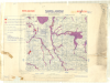
| Osnabruck, Germany. 1:250,000. Map Sheet K53, 5th Edition, Flooding Overprint, 26 March 1945 |
Great Britain. War Office. General Staff. Geographical Section. |
1945 |
|
| Other Transportation - Lines (OTL) |
DMTI Spatial Inc. |
2001 - 2014 |

|
| Other Transportation - Points (OTP) |
DMTI Spatial Inc. |
2001 - 2014 |

|
| Other Transportation - Regions (OTR) |
DMTI Spatial Inc. |
2001 - 2014 |

|
| Ottawa Vector Data Set |
City of Ottawa |
2007 |

|
| Paleozoic Geology of Southern Ontario |
Ontario Geological Survey |
2007 |
|
| Park Sports Field Point |
DMTI Spatial Inc. |
2015 - 2023 |

|
| Park Sports Field Region |
DMTI Spatial Inc. |
2015 - 2023 |

|
| Parks and Recreation - Lines (PRL) |
DMTI Spatial Inc. |
2001 - 2014 |

|
| Parks and Recreation - Points (PRP) |
DMTI Spatial Inc. |
2001 - 2014 |
|