Geospatial Data
| Title Sort descending | Author | Year | Sample |
|---|---|---|---|
| Predicted Species Distributions and Vegetation Assemblages for Eco-district 6e10 | Ontario Ministry of Natural Resources | 2005 - 2008 | |
| Primary Highway Casements (HPC) | DMTI Spatial Inc. | 2001 - 2014 | 
|
| Prince Edward Island GIS Data Catalog | The Government of Prince Edward Island |
Current, some historical | |
| Province | Ontario Ministry of Natural Resources | 2003 - 2008 | 
|
| Province at 1 Million | Ontario Ministry of Natural Resources | 1983 | 
|
| Provincial Boundaries (PRV) | DMTI Spatial Inc. | 2001 - 2014 | 
|
| Provincial Digital Elevation Model - Version 3.0 | Ontario Ministry of Natural Resources | 2013 - 350. | |
| Provincial Landcover 2000 - 27 Classes | Ontario Ministry of Natural Resources | 1999 - 2002 | 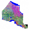
|
| Provincial Park Regulated | Ontario Ministry of Natural Resources | 1893 - 2008 | 
|
| Provincial Riding Archive May 2004 | Ontario Ministry of Natural Resources | 1998 - 2004 | 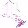
|
| Provincial Satellite Derived Disturbance Mapping | Ontario Ministry of Natural Resources | 2010 - 2012 | 
|
| Public Health Units (PHU) | Ontario Ministry of Health and Long-Term Care | 2011 - 2012 | 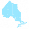
|
| PurpleAir | Purple Air, Inc. | Various | |
| Quaternary Geology of Ontario | Ontario Ministry of Northern Development and Mines | 1950 - 1988 | 
|
| Quickbird Satellite Imagery - AFFM: Multispectral imagery, true colour | Ontario Ministry of Natural Resources | 2003 - 2008 | 
|
| Quickbird Satellite Imagery - AFFM: Panchromatic imagery, greyscale | Ontario Ministry of Natural Resources | 2003 - 2008 | 
|
| QuickBird Satellite Imagery - Source Water Protection: Multi-spectral imagery, false colour | Ontario Ministry of Natural Resources | 2005 - 2007 | 
|
| QuickBird Satellite Imagery - Source Water Protection: Multi-spectral imagery, true colour | Ontario Ministry of Natural Resources | 2005 - 2007 | 
|
| QuickBird Satellite Imagery - Source Water Protection: Pan sharpened imagery, false colour | Ontario Ministry of Natural Resources | 2005 - 2007 | 
|
| QuickBird Satellite Imagery - Source Water Protection: Pan sharpened imagery, true colour | Ontario Ministry of Natural Resources | 2005 - 2007 | 
|