Year
1998 - 2004
Abstract
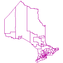
This data set can be used to identify a Provincial Riding, which is a polygon feature that identifies the locations and extents of provincial political ridings in Ontario.
Please note that the data was loaded into the LIO warehouse in 1998, however, it is unknown what the currency of the data is. Please use caution when interpreting data and results.
Supplementary tables can be used and are available for download from the additional documentation section.
URL
Access this resource on Scholars Geoportal.
SGP_id
2883584505
Scholars Geoportal URL
Access this resource on Scholars Geoportal.