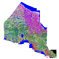
The Ontario Land Cover Data Base, Second Edition (2000) provides a classification of 27 broad land cover types north of the southern boundary of the Canadian Shield, within the province of Ontario. The land cover classes consist of vegetation types (such as forest, wetlands, and agricultural crops or pasture) and categories of non-vegetated surface (such as waterbodies, bedrock outcrops, or settlements). These classes reflect the nature of the land surface rather than actual or potential land use.
The 2000 Edition of the Ontario Land Cover Data Base is the Second Edition of this provincial land cover classification. The coverage is derived wholly from Landsat-7 Thematic Mapper (TM) satellite data frames recorded between 1999 and 2002, most from 2000 onward.
The Provincial Land Cover (2000) Data Base is divided into four individual Universal Transverse Mercator (UTM) grid zone tiles (15, 16, 17, 18) and is being distributed in TIFF format. Documentation is provided with this database in the form of a user's guide and general use caveats.
Access this resource on Scholars Geoportal.
Access this resource on Scholars Geoportal.