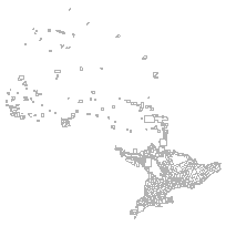
This data set can be used to identify municipalities within Ontario at a scale of 1:1,000,000.
Please note that this data set is dated and has not been maintained since 1983. It is not intended for high accuracy geo-referencing but rather for approximate locations of features and general information.
Supplementary tables can be used and are available for download from the additional documentation section.
Access this resource on Scholars Geoportal.
Access this resource on Scholars Geoportal.
