Geospatial Data
| Title Sort descending | Author | Year | Sample |
|---|---|---|---|
| Forest Abiotic Damage Event | Ontario Ministry of Natural Resources | 1998 - 2009 | 
|
| Forest Cover | Ontario Ministry of Natural Resources | 2010 | 
|
| Forest Cover - Quetico Provincial Park (3D) | Ontario Ministry of Natural Resources | 1986 - 2011 | 
|
| Forest Disease Damage Event | Ontario Ministry of Natural Resources | 2008 | 
|
| Forest Insect Damage Event | Ontario Ministry of Natural Resources | 1998 - 2008 | 
|
| Forest Management Unit | Ontario Ministry of Natural Resources | 2006 | 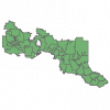
|
| Forest Misc. Damage Event | Ontario Ministry of Natural Resources | 2008 | 
|
| Forest Processing Facility | Ontario Ministry of Natural Resources | 1998 - 2008 | 
|
| Forest Resource Inventory (FRI), Wetland | Ontario Ministry of Natural Resources | 2012 | 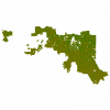
|
| Forest Resources Inventory (FIM v2 3D) Packaged Product | Ontario Ministry of Natural Resources | 2007 | 
|
| Forest Resources Inventory Status (FRI-Status) | Ontario Ministry of Natural Resources | 2011 | 
|
| Forest Resources Planning Composite Inventory (FRI-PCI) | Ontario Ministry of Natural Resources | 2004 - 2011 | 
|
| General Water Region | DMTI Spatial Inc. | 2015 - 2023 | 
|
| GEOWeb, The District of North Vancouver's Open Data Portal | Corporation of the District of North Vancouver |
Varies by dataset | 
|
| Global Biodiversity Information Facility (GBIF) Data Portal | Global Biodiversity Information Facility |
Varies by dataset | |
| Global Land Resources GIS Models and Databases for Poverty and Food Insecurity Mapping | United Nations. Food and Agriculture Organization (FAO) |
2002 | |
| Global Map of Irrigation Areas (GMIA) | United Nations. Food and Agriculture Administration (FAO) |
2013 | |
| Grand River Information Network | Grand River Conservation Authority |
Various | |
| Great Lakes Conservation Blueprint for Biodiversity | Ontario Ministry of Natural Resources | 2005 | 
|
| Great Lakes Information Network (GLIN), Great Lakes Mapping & GIS | Great Lakes Commission |
Various |
