Geospatial Data
| Title Sort descending | Author | Year | Sample |
|---|---|---|---|
| "Make a Topographic Map" Utility | Ontario Ministry of Natural Resources and Forestry |
2014 | |
| 2020 Land Cover of Canada | CCRS, CCMEO, NRCAN | 2022-2024 | |
| ASTER Global Digital Elevation Model (GDEM) | Produced jointly by Japan's Ministry of Economy, Trade and Industry (METI) and the U.S. National Aeronautics and Space Administration (NASA). |
2011 (version 2) | 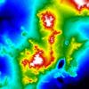
|
| Canada Elevation Data | ESRI Canada | Various | |
| Canadian Digital Elevation Data (1:50,000) | Natural Resorces Canada |
2006 | |
| Canadian Digital Elevation Model (CDEM) | Natural Resources Canada |
1945-2011 | |
| Canadian Digital Surface Model (CDSM) | Natural Resources Canada |
2000 | |
| CanVec Series | Natural Resources Canada |
2016-2019 | |
| City of Toronto Open Data | City of Toronto |
Varies by dataset | 
|
| City of Vancouver Open Data Portal | City of Vancouver |
Varies by dataset | 
|
| Conservation Halton Open Data | Conservation Halton | Curent | |
| Contours | Ontario Ministry of Natural Resources | 1977 - 2006 | 
|
| Contours Line | DMTI Spatial Inc. | 2015 - 2023 | 
|
| DataMB | Government of Manitoba | Varies by dataset | |
| Digital Elevation Model (DEM) | DMTI Spatial Inc. |
Various, as derived from NTDB | |
| Digital Elevation Model (DEM) - Provincial Tiled Dataset | Ontario Ministry of Natural Resources | 2006 - 2015 | 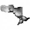
|
| Digital Raster Acquisition Project Eastern Ontario (DRAPE) 2014 Digital Elevation Model | Ontario Ministry of Natural Resources | 2015 | 
|
| Digital Terrain Model of Southern Ontario | Ontario Ministry of Natural Resources | 2002 | 
|
| Earth Resources and Land Information System (ERLIS) Data Series | Ontario Geological Survey |
Varies, by dataset | |
| Elevation Point | DMTI Spatial Inc. | 2015 - 2023 | 
|
