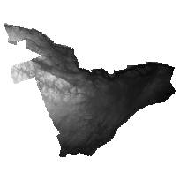
The DRAPE 2014 DEM is a 2m raster elevation product that represents a generalized representation of both surface and ground features. The product was generated by an imagery contractor for the purpose of ortho-rectifying the DRAPE 2014 ortho-photography. Digital Raster Acquisition Project Eastern Ontario (DRAPE) ortho-photography was collected through a collaborative funding partnership for eastern Ontario. Contributing organizations include the Ontario Government, municipalities, Conservation Authorities, the private sector and the Federal Government.
DRAPE 2014 DEM contains 37,290 non-overlapping tiles (1km x 1km) covering the Counties of Frontenac, Lanark, Lennox and Addington, Renfrew, the United Counties of Leeds and Grenville, Prescott and Russell, Stormont, Dundas and Glengarry, the Towns of Prescott, Gananoque and Smiths Falls, the Township of South Algonquin and the Cities of Cornwall, Brockville, Kingston and Ottawa.
Access this resource on Scholars Geoportal.
Access this resource on Scholars Geoportal.
