Geospatial Data
| Title Sort descending | Author | Year | Sample |
|---|---|---|---|
| Mississauga Ward Boundaries | Transportation and Works Department, City of Mississauga | 2016 - 2020 | 
|
| Mississauga Z-Area Boundaries | Transportation and Works Department, City of Mississauga | 2016 - 2020 | 
|
| MNR Area | Ontario Ministry of Natural Resources | 2008 | 
|
| MNR District | Ontario Ministry of Natural Resources | 2007 - 2008 | 
|
| MNR Region | Ontario Ministry of Natural Resources | 2007 - 2008 | 
|
| Multiple Enhanced Postal Codes (MEP) | DMTI Spatial Inc. | 2001 - 2014 | 
|
| Municipal Amalgamation File (MAF) | DMTI Spatial Inc. | 2002 - 2014 | 
|
| Municipal at 1 Million | Ontario Ministry of Natural Resources | 1983 | 
|
| Municipal Boundaries (MUN) | DMTI Spatial Inc. | 2001 - 2014 | 
|
| Municipal Boundaries 1996 | Ontario Ministry of Natural Resources | 1996 | 
|
| Municipal Boundaries 2005 | Ontario Ministry of Natural Resources | 2005 | 
|
| Municipal Boundary - Lower and Single Tier | Ontario Ministry of Natural Resources | 2012 | 
|
| Municipal Boundary - Upper Tier and District | Ontario Ministry of Natural Resources | 2012 | 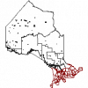
|
| Municipalities Region | DMTI Spatial Inc. | 2015 - 2023 | 
|
| Natural Earth | Many volunteer NACIS members and cartographers around the globe outlined below: https://www.naturalearthdata.com/about/contributors/ | 2009-2024 | |
| Navigate Burlington | City of Burlington | Varies by dataset | |
| Neighbourhood and Community Boundaries, Communities Boundary File (CMN) | DMTI Spatial Inc. | 2008 - 2014 | 
|
| Neighbourhood and Community Boundaries, Neighbourhood Boundary File (NBH) | DMTI Spatial Inc. | 2008 - 2014 | 
|
| Niagara Open Data | Varies by dataset | ||
| Oak Ridges Moraine Conservation Plan Datasets | Ontario Ministry of Natural Resources |
1983 - 2006 |
