Year
2007 - 2008
Abstract
Revision Note: Please note that this dataset has been revised and is available from the Land Information Ontario (LIO) Warehouse.
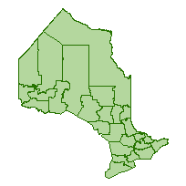
Land identifying MNR administrative areas that divides MNR Regions into smaller organizational units for the purpose of managing Ministry programs and resources at a district level.
Extents of the districts were originally compiled by description of: metes and bounds, topographic features, geographic township boundaries, territorial district boundaries, etc. Changes to the extents of the districts have been made through the years by the district offices.
URL
Access this resource on Scholars Geoportal.
SGP_id
3538283390
Scholars Geoportal URL
Access this resource on Scholars Geoportal.