Geospatial Data
| Title Sort descending | Author | Year | Sample |
|---|---|---|---|
| Wind Power Allocation Block | Ontario Ministry of Natural Resources | 2004 | 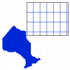
|
| Wind Resource Information | Helimax Energy Inc. |
2005 | |
| Winter Roads Table | DMTI Spatial Inc. | 2018 - 2023 | |
| Wintering Area | Ontario Ministry of Natural Resources | 1997 - 2006 | 
|
| Wood Use Area | Ontario Ministry of Natural Resources | 1998 - 2005 | 
|
| Wooded Area | Ontario Ministry of Natural Resources | 1976 - 2006 | 
|
| World Latitude and Longitude Grids | ESRI | 2002 - 2008 | 
|
| World Time Zones | ESRI | 2002 - 2008 | 
|
| World UTM Zones | ESRI | 2000 - 2008 | 
|
| World Vector Shoreline Plus (WVSPLUS) | LAND INFO Worldwide Mapping, LLC |
2004 | |
| Xanten, Germany. 1:25,000. Map Sheet 4304, 3rd Edition, December 1944 | Great Britain. War Office. General Staff. Geographical Section. | 1944 | 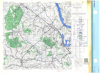
|
| Xanten, Germany. 1:25,000. Map Sheet 4304, 3rd Edition, Defence Overprint, 20 February 1945 | Great Britain. War Office. General Staff. Geographical Section. | 1945 | 
|
| Yukon Digital Elevation Data | Government of Yukon and Natural Resources Canada | Varies by dataset | |
| Yukon Digital Geology | Geological Survey of Canada |
2003 | |
| Zeebrugge NW, France and Belgium. 1:25,000. Map Sheet 21 NW, Defence Overprint, 9 October 1944 | Great Britain. War Office. General Staff. Geographical Section. | 1944 | 
|
| Zeebrugge SW, France and Belgium. 1:25,000. Map Sheet 21 SW, Defence Overprint, 10 September 1944 | Great Britain. War Office. General Staff. Geographical Section. | 1944 | 
|
| Zeebrugge SW, France and Belgium. 1:25,000. Map Sheet 21 SW, Defence Overprint, 3 October 1944 | Great Britain. War Office. General Staff. Geographical Section. | 1944 | 
|
| Zoning By-law Boundary | Open Hamilton, The City of Hamilton | Current | |
| Zutphen, Eastern Holland. 1:25,000. Map Sheet 3803, 2nd Edition, Geological Overprint, 1944 | United States. Army Map Service | 1944 | 
|
