Year
1945
Abstract
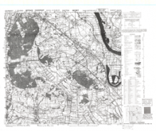
This is a 1:25,000 scale map (defence overprint) of the region of Xanten, Germany. It is the third edition of this map, published on February 20, 1945 by the Geographical Section, General Staff (GSGS) of the War Office of Great Britain.
This overprint was referenced from air photographs taken February 16, 1945, and utilizes the Nord de Guerre Zone Grid.
Production information for the map is 3220/2/45/3RCE/5665.
URL
Access this resource on Scholars Geoportal.
SGP_id
WWIIMMXanten_1945_TIFF
Scholars Geoportal URL
Access this resource on Scholars Geoportal.
