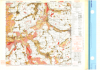
| Vlissingen West, Holland. 1:25,000. Map Sheet 14 SW West, Defence Overprint, Walcheren, 14 September 1944 |
United States. Army Map Service |
1944 |

|
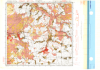
| Waldniel, Germany. 1:25,000. Map Sheet 4703, Going Map, 1944 |
Great Britain. War Office. General Staff. Geographical Section. |
1944 |
|
| Waste Disposal Site - Replaced |
Ontario Ministry of Natural Resources |
1997 - 2012 |

|
| Waste Management Attenuation Zone |
Ontario Ministry of Natural Resources |
2012 |

|
| Waste Management Site |
Ontario Ministry of Natural Resources |
2012 |

|
| Water Area at 1 Million |
Ontario Ministry of Natural Resources |
1983 |

|
| Water Line at 1 Million |
Ontario Ministry of Natural Resources |
1983 |

|
| Water Lot - Replaced |
Ontario Ministry of Natural Resources |
1997 - 2012 |

|
| Water Resources Information Program (WRIP) Water Well Locations Phase 3 |
Ontario Ministry of Natural Resources |
1899 - 2006 |

|
| Water Supply |
Ontario Ministry of Natural Resources |
2008 |

|
| Water Virtual Flow - Seamless Provincial Data Set |
Ontario Ministry of Natural Resources |
1998 - 2008 |

|
| Waterloo Region Historic Air Photo Collection |
Unknown |
1930, 1945-47, 1955, 1963 and 1966 |
|
| Waterpower Generation Station |
Ontario Ministry of Natural Resources |
2001 |

|
| Waterpower Policy Areas |
Ontario Ministry of Natural Resources |
2005 |

|
| Waterpower Potential Site |
Ontario Ministry of Natural Resources |
1985 - 2004 |

|
| Watershed |
Ontario Ministry of Natural Resources |
2002 - 2010 |

|
| Wegberg, Germany. 1:25,000. Map Sheet 4803, Going Map, 1944 |
Great Britain. War Office. General Staff. Geographical Section. |
1944 |
|
| Wesel, Germany. 1:25,000. Map Sheet 4305, 3rd Edition, Defence Overprint, 19 January 1945 |
Great Britain. War Office. General Staff. Geographical Section. |
1945 |
|
| Wesel, Germany. 1:25,000. Map Sheet 4305, 3rd Edition, Defence Overprint, 22 January 1945 |
Great Britain. War Office. General Staff. Geographical Section. |
1945 |
|
| Wesel, Germany. 1:25,000. Map Sheet 4305, 3rd Edition, Defence Overprint, 6 February 1945 |
Great Britain. War Office. General Staff. Geographical Section. |
1945 |
|