| Niagara Air Photo Index |
Canada Department of Energy, Mines & Resources |
1921 - 2020 |
|
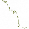
| Niagara Escarpment Parks and Open Space System (NEPOSS) |
Ontario Ministry of Natural Resources |
2005 |
|
| Niagara Escarpment Plan Boundary |
Niagara Escarpment Commission |
2005 |

|
| Niagara Open Data |
|
Varies by dataset |
|
| North West Ontario Orthophotography Project (NWOOP) 2017 - Imagery |
Ontario Ministry of Natural Resources |
2017 |

|
| North West Ontario Orthophotography Project (NWOOP) 2017 Digital Elevation Model (DEM) |
Ontario Ministry of Natural Resources |
2018 |

|
| North West Ontario Orthophotography Project (NWOOP) 2022 - Imagery |
Ontario Ministry of Natural Resources |
2022 - 2023 |

|
| Nursery Areas |
Ontario Ministry of Natural Resources |
1997 - 2006 |

|
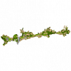
| Oak Ridges Moraine - Land Use Designations |
Ontario Ministry of Natural Resources |
2002 |
|
| Oak Ridges Moraine - Landform Conservation Area |
Ontario Ministry of Natural Resources |
2002 - 2006 |

|
| Oak Ridges Moraine - Planning Area |
Ontario Ministry of Natural Resources |
2001 |

|
| Oak Ridges Moraine - Rare, Threatened & Endangered (RTE) Species Occurrences Generalized |
Ontario Ministry of Natural Resources |
1998 - 2002 |

|
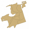
| Oak Ridges Moraine - Sand Barrens, Savannahs, Tallgrass Prairies |
Ontario Ministry of Natural Resources |
1998 - 2002 |
|
| Oak Ridges Moraine - Subwatersheds (Points) |
Ontario Ministry of Natural Resources |
2003 |

|
| Oak Ridges Moraine - Subwatersheds (Polygons) |
Ontario Ministry of Natural Resources |
2003 |

|
| Oak Ridges Moraine Conservation Plan Datasets |
Ontario Ministry of Natural Resources |
1983 - 2006 |
|
| Oakville Digital Orthoimagery, 1999 - Partial Only |
City of Mississauga Transportation and Works Department |
1999 |

|
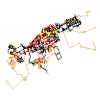
| OC Transpo Transit Routes |
OC Transpo |
2014 - 2020 |
|
| Ontario Airborne Geophysical Surveys, Magnetic and Electromagnetic Data, Latchford Area |
Ontario Ministry of Northern Development and Mines |
2013 |
|
| Ontario Base Map (OBM) Digital Data |
Ontario Ministry of Natural Resources |
1977 - 2008 |

|