Geospatial Data
| Title Sort descending | Author | Year | Sample |
|---|---|---|---|
| "Make a Topographic Map" Utility | Ontario Ministry of Natural Resources and Forestry |
2014 | |
| Agreement Forest Area | Ontario Ministry of Natural Resources | 1997 - 2004 | 
|
| Agro-MAPS Global | United Nations. Food and Agriculture Organization (FAO) |
2005 | |
| Air Quality Data Sets: Pollutant and Smog Data and Forecasts | Ontario Ministry of the Environment, Conservation, and Parks | Various, from 2000 | |
| Aquaculture Area of Impact | Ontario Ministry of Natural Resources | 2004 - 2011 | 
|
| Aquatic Feeding Area | Ontario Ministry of Natural Resources | 1997 - 2006 | 
|
| Aquatic Resource Area | Ontario Ministry of Natural Resources | 2009 - 2011 | 
|
| Arctic Spatial Data Infrastructure | Operated by National Land Survey of Finland in the Arctic SDI cloud environment hosted by the Norwegian Mapping Authority. Contributions by National Mapping Agencies and other partners and affiliates. | ||
| Areas of Natural and Scientific Interest (ANSI) | Ontario Ministry of Natural Resources | 1997 - 2012 | 
|
| ASTER Global Digital Elevation Model (GDEM) | Produced jointly by Japan's Ministry of Economy, Trade and Industry (METI) and the U.S. National Aeronautics and Space Administration (NASA). |
2011 (version 2) | 
|
| Atiku: The Northern and Arctic Studies Portal | Collaboration between Quebec universities (Concordia, INRS, Laval, McGill, UQÀM) and Bibliothèque et archives nationales du Québec | Various | |
| Atlas of the Biosphere | The Nelson Institute Center for Sustainability and the Global Environment, University of Wisconsin-Madison |
1998 - 2001 | |
| Bait Harvest Area | Ontario Ministry of Natural Resources | 2006 - 2012 | 
|
| Beaver Dam | Ontario Ministry of Natural Resources | 1976 - 2008 | 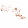
|
| Breeding Area | Ontario Ministry of Natural Resources | 1998 - 2004 | 
|
| Broad Scale Monitoring Lakes Fisheries Management Zone 5 (FMZ5) | Ontario Ministry of Natural Resources | 2010 | 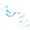
|
| Calving Fawning Site | Ontario Ministry of Natural Resources | 1997 - 2006 | 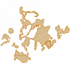
|
| Camp, Work | Ontario Ministry of Natural Resources | 1997 - 2006 | 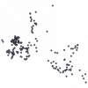
|
| Canada Land Inventory (CLI) - Land Capability for Agriculture | Agriculture and Agri-Food Canada |
2013 | |
| Canada Land Inventory (CLI) - Land Capability for Forestry | Natural Resources Canada |
Various |
