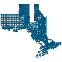
This data set can be used to identify the extent of Bait Harvest Areas throughout the province. The bait resource in much of the province is allocated to harvesters through the use of a block system with block sizes generally much larger in the north than in the south. The block system may be allocated to multiple users fishing the same area. This data set includes the following bait harvest areas:
Supplementary tables can be used and are available for download from the additional documentation section. Supplementary look-up table descriptions are available in the data description document, which is available for download from the additional documentation section. This layer is part of what was known as the OMNR Non-Fundamental Dataset.
Access this resource on Scholars Geoportal.
Access this resource on Scholars Geoportal.
