| geoBoundaries |
William & Mary geoLab |
Varies |
|
| Geographic Attribute File (GAF), 1971 Census |
Statistics Canada |
1972 |
|
| Geographic Attribute File (GAF), 1976 Census |
Statistics Canada |
1978 |
|
| Geographic Attribute File (GAF), 1981 Census |
Statistics Canada |
1983 |
|
| Geographic Attribute File (GAF), 1986 Census |
Statistics Canada |
1988 |
|
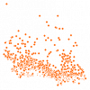
| Geographic Attribute File (GAF), 1991 Census |
Statistics Canada |
1993 |
|
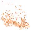
| Geographic Attribute File (GAF), 1996 Census |
Statistics Canada |
1997 |
|
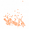
| Geographic Attribute File (GAF), 2006 Census |
Statistics Canada |
2007 |
|
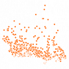
| Geographic Attribute File (GAF), 2011 Census |
Statistics Canada |
2011 |
|
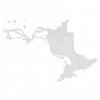
| Geographic Township Improved |
Ontario Ministry of Natural Resources |
1977 - 2013 |
|
| GEOWeb, The District of North Vancouver's Open Data Portal |
Corporation of the District of North Vancouver |
Varies by dataset |

|
| Global Administrative Areas (GADM) |
University of California |
2015-2022 |
|
| Global Land Resources GIS Models and Databases for Poverty and Food Insecurity Mapping |
United Nations. Food and Agriculture Organization (FAO) |
2002 |
|
| Grand River Information Network |
Grand River Conservation Authority |
Various |
|
| Great Britain Ordnance Survey (OS) Open Data |
Ordnance Survey |
Varies by dataset |
|
| Great Lakes Information Network (GLIN), Great Lakes Mapping & GIS |
Great Lakes Commission |
Various |
|
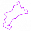
| Greater Toronto and Hamilton Area (GTHA) Boundary |
Ontario Ministry of Natural Resources |
2012 |
|
| Greater Toronto and Hamilton Area (GTHA) Boundary |
DMTI Spatial Inc. |
2002 - 2012 |
|
| Greater Toronto Area (GTA) Boundary |
DMTI Spatial Inc. |
2012 |
|
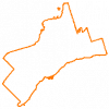
| Greater Toronto Area (GTA) Boundary |
Ontario Ministry of Natural Resources |
2012 |
|