| GeoCover Landsat 4/5 |
LandInfo Worldwide Mapping LLC |
1990 |
|
| GeoCover Landsat 7 |
LandInfo Worldwide Mapping LLC |
2000 |
|
| GeoEye Satellite Image of Downtown Toronto - 2007 |
GeoEye |
2007 |

|
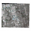
| GeoEye Satellite Image of North York - 2009 |
GeoEye |
2009 |
|
| Geographic Attribute File (GAF), 1971 Census |
Statistics Canada |
1972 |
|
| Geographic Attribute File (GAF), 1976 Census |
Statistics Canada |
1978 |
|
| Geographic Attribute File (GAF), 1981 Census |
Statistics Canada |
1983 |
|
| Geographic Attribute File (GAF), 1986 Census |
Statistics Canada |
1988 |
|
| Geographic Attribute File (GAF), 1991 Census |
Statistics Canada |
1993 |
|
| Geographic Attribute File (GAF), 1996 Census |
Statistics Canada |
1997 |
|
| Geographic Attribute File (GAF), 2006 Census |
Statistics Canada |
2007 |
|
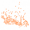
| Geographic Attribute File (GAF), 2011 Census |
Statistics Canada |
2011 |
|
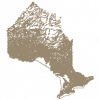
| Geographic Named Extent |
Ontario Ministry of Natural Resources |
1500 - 2011 |
|
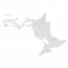
| Geographic Township Improved |
Ontario Ministry of Natural Resources |
1977 - 2013 |
|
| Geographical Names Data |
Natural Resources Canada |
Current |
|
| Geological Map of Canada |
Geological Survey of Canada |
1996 |
|
| GeoPinpoint Suite |
DMTI Spatial Inc. |
2008, 2011 |
|
| GEOWeb, The District of North Vancouver's Open Data Portal |
Corporation of the District of North Vancouver |
Varies by dataset |

|
| Global Administrative Areas (GADM) |
University of California |
2015-2022 |
|
| Global Biodiversity Information Facility (GBIF) Data Portal |
Global Biodiversity Information Facility |
Varies by dataset |
|