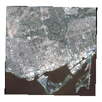
This dataset consists of an georeferenced GeoEye (IKONOS-2) Satellite Image taken on July 3, 2007. The image is of Downtown Toronto.
The dataset package consists of two image files in GeoTIFF format: A a 11bit panchromatic (black and white) image with a 1 metre resolution and multispectral image with a 4 metre resolution. The multispectral image contains the following four bands:
- Band 1 = Blue
- Band 2 = Green
- Band 3 = Red
- Band 4 = Near-infrared
Additional product metadata and HDR files containing raster parameters are available in the additional documentation section below
Access this resource on Scholars Geoportal.
Access this resource on Scholars Geoportal.
