Geospatial Data
| Title Sort descending | Author | Year | Sample |
|---|---|---|---|
| Land Use Plan Area, MNR | Ontario Ministry of Natural Resources | 2006 | 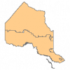
|
| Miscellaneous Line | Ontario Ministry of Natural Resources | 1977 - 2007 | 
|
| Miscellaneous Point | Ontario Ministry of Natural Resources | 1977 - 2007 | 
|
| Mississauga Official Plan 2010 Land Use Area | Transportation and Works Department, City of Mississauga | 2016 - 2020 | 
|
| Mississauga Policy Code Area (Existing Land Use) | Transportation and Works Department, City of Mississauga | 2016 - 2020 | 
|
| Mississauga Zoning | Transportation and Works Department, City of Mississauga | 2016 - 2020 | 
|
| Navigate Burlington | City of Burlington | Varies by dataset | |
| Niagara Open Data | Varies by dataset | ||
| Ontario Parcel Boundaries | Teranet Inc. |
2009 - 2022 | |
| Ontario Parcel Boundaries 2024 | Teranet Inc. | 2024 | |
| Open Hamilton | City of Hamilton | Varies by dataset | |
| OpenStreetMap - Geofabrik Download Server | Various | 2018 - 2024 | |
| Patent Land External | Ontario Ministry of Natural Resources | 2010 - 2013 | 
|
| Peat Production Area | Ontario Ministry of Natural Resources | 1997 - 2005 | 
|
| Potential Tourism Area | Ontario Ministry of Natural Resources | 1997 - 2006 | 
|
| Provincial Landcover 2000 - 27 Classes | Ontario Ministry of Natural Resources | 1999 - 2002 | 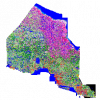
|
| Recreation Point | Ontario Ministry of Natural Resources | 1997 - 2006 | 
|
| Research Plot | Ontario Ministry of Natural Resources | 1900 - 2006 | 
|
| Southern Ontario Land Use (circa 1966) - Canada Land Inventory (1:50,000) | Ducks Unlimited Canada | 1950 - 2009 | 
|
| The City of London's Open Data Catalogue | City of London, Ontario |
Varies by dataset | 
|