Geospatial Data
| Title Sort descending | Author | Year | Sample |
|---|---|---|---|
| Water Virtual Flow - Seamless Provincial Data Set | Ontario Ministry of Natural Resources | 1998 - 2008 | 
|
| Waterloo Region Historic Air Photo Collection | Unknown | 1930, 1945-47, 1955, 1963 and 1966 | |
| Waterpower Generation Station | Ontario Ministry of Natural Resources | 2001 | 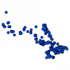
|
| Waterpower Policy Areas | Ontario Ministry of Natural Resources | 2005 | 
|
| Waterpower Potential Site | Ontario Ministry of Natural Resources | 1985 - 2004 | 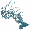
|
| Watershed | Ontario Ministry of Natural Resources | 2002 - 2010 | 
|
| Wetland Unit | Ontario Ministry of Natural Resources | 1978 - 2011 | 
|
| Wild Rice Stand | Ontario Ministry of Natural Resources | 1997 - 2006 | 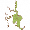
|
| Wilderness Area | Ontario Ministry of Natural Resources | 1980 - 2006 | 
|
| Wildlife Management Unit | Ontario Ministry of Natural Resources | 2006 | 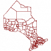
|
| Wildlife Management Units - Legal Map Copies July 2006 | Ontario Ministry of Natural Resources | 2006 | 
|
| Wind Power Allocation Block | Ontario Ministry of Natural Resources | 2004 | 
|
| Wind Resource Information | Helimax Energy Inc. |
2005 | |
| Wintering Area | Ontario Ministry of Natural Resources | 1997 - 2006 | 
|
| Wood Use Area | Ontario Ministry of Natural Resources | 1998 - 2005 | 
|
| Wooded Area | Ontario Ministry of Natural Resources | 1976 - 2006 | 
|
