Geospatial Data
| Title Sort descending | Author | Year | Sample |
|---|---|---|---|
| Southwestern Ontario Orthophotography Project (SWOOP) 2015 Classified LAS | Ontario Ministry of Natural Resources | 2016 | 
|
| Southwestern Ontario Orthophotography Project (SWOOP) 2015 Digital Terrain Model (DTM) | Ontario Ministry of Natural Resources | 2017 | 
|
| Southwestern Ontario Orthophotography Project (SWOOP) 2020 - 1km x 1km coverage | Ontario Ministry of Natural Resources | 2020 - 2021 | 
|
| Spawning Area | Ontario Ministry of Natural Resources | 1997 - 2006 | 
|
| Species Observation, Locally Tracked | Ontario Ministry of Natural Resources | 1998 - 2012 | 
|
| Species Occurrence, Provincially Tracked | Ontario Ministry of Natural Resources | 1777 - 2012 | |
| Spot Height | Ontario Ministry of Natural Resources | 1977 - 2009 | 
|
| Staging Area, Fish | Ontario Ministry of Natural Resources | 1998 - 2006 | 
|
| Staging Area, Wildlife | Ontario Ministry of Natural Resources | 1998 - 2005 | 
|
| Stewardship Council Area | Ontario Ministry of Natural Resources | 2010 - 2013 | 
|
| Stewardship Council Location | Ontario Ministry of Natural Resources | 2010 - 2013 | 
|
| Stewardship Zone | Ontario Ministry of Natural Resources | 2010 - 2013 | 
|
| Street Network Files (SNF), 1991 Census | Statistics Canada | 1992 | 
|
| Street Network Files (SNF), 1996 Census | Statistics Canada | 1997 | 
|
| Surficial Geology of Southern Ontario - Line Representation | Ontario Ministry of Northern Development, Mines and Forestry | 2003 - 2010 | 
|
| Surficial Geology of Southern Ontario - Miscellaneous | Ontario Ministry of Northern Development, Mines and Forestry | 2003 - 2010 | 
|
| Surficial Geology of Southern Ontario - Moraines | Ontario Ministry of Northern Development, Mines and Forestry | 2003 - 2010 | 
|
| Surficial Geology of Southern Ontario - Point Representation | Ontario Ministry of Northern Development, Mines and Forestry | 2003 - 2010 | 
|
| Surficial Geology of Southern Ontario - Polygon Representation | Ontario Ministry of Northern Development, Mines and Forestry | 2003 - 2010 | 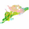
|
| Surficial Materials of Canada Map - 1880A | Natural Resources Canada |
1995 | 
|