| Great Lakes Information Network (GLIN), Great Lakes Mapping & GIS |
Great Lakes Commission |
Various |
|
| Great Lakes Islands (International) - Grouped Coastal Environments |
Ontario Ministry of Natural Resources |
2006 - 2010 |

|
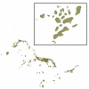
| Great Lakes Islands (International) - Islands |
Ontario Ministry of Natural Resources |
2006 - 2010 |
|
| Greater Toronto and Hamilton Area (GTHA) Boundary |
DMTI Spatial Inc. |
2002 - 2012 |
|
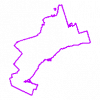
| Greater Toronto and Hamilton Area (GTHA) Boundary |
Ontario Ministry of Natural Resources |
2012 |
|
| Greater Toronto Area (GTA) Boundary |
DMTI Spatial Inc. |
2012 |
|
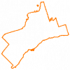
| Greater Toronto Area (GTA) Boundary |
Ontario Ministry of Natural Resources |
2012 |
|
| Greater Toronto Area (GTA) Orthophotography - 1995 |
Ontario Ministry of Natural Resources |
1995 |
|
| Greater Toronto Area (GTA) Orthophotography Collection (2009-2010) |
Ontario Ministry of Natural Resources |
2010 - 2011 |

|
| Greater Toronto Area (GTA) Orthophotography Project 2002: 10km coverage |
Ontario Ministry of Natural Resources |
2002 |
|
| Greater Toronto Area (GTA) Orthophotography Project 2002: 1km coverage |
Ontario Ministry of Natural Resources |
2002 |
|
| Greater Toronto Area (GTA) Orthophotography Project 2002: 20km coverage |
Ontario Ministry of Natural Resources |
2002 |
|
| Greater Toronto Area (GTA) Orthophotography Project 2005 |
Ontario Ministry of Natural Resources |
2005 |
|
| Greater Toronto Area (GTA) Orthophotography Project 2007 |
Ontario Ministry of Natural Resources |
2007 |
|
| Greater Toronto Area (GTA) Orthophotography Project 2013 |
Ontario Ministry of Natural Resources |
2014 |
|
| Greenbelt Designation |
Ontario Ministry of Municipal Affairs and Housing |
2005 - 2013 |
|
| Greenbelt Natural Heritage System - Areas REPLACED |
Ontario Ministry of Natural Resources |
2005 - 2015 |
|
| Greenbelt Natural Heritage System - Urban River Connections |
Ontario Ministry of Natural Resources |
2005 |
|
| Greenbelt Outer Boundary |
Ontario Ministry of Municipal Affairs and Housing |
2005 - 2013 |
|
| Greenbelt Selected Wildlife Habitat |
Ontario Ministry of Natural Resources |
1997 - 1999 |

|