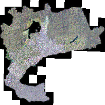
The Greater Toronto Area (GTA) Orthophotography Project 2002 consists of over 26,000 one-square-kilometer tiles of orthorectified colour imagery for the Greater Toronto Area. The imagery features 20 cm pixels for Niagara, Hamilton, Halton, Peel, York, Toronto and Durham, 30 cm pixels for Simcoe, and 50cm pixels for Peterborough and Northumberland. The imagery was flown in the spring of 2002.
The 20km coverage was created by mosaicing together 10km x 10km tiles into 20km x 20km tiles and reducing the resolution to a common pixel size of 5m. The scope of this project did not include adjustment of colours from the original source images.
Access this resource on Scholars Geoportal.
Access this resource on Scholars Geoportal.
