Geospatial Data
| Title Sort descending | Author | Year | Sample |
|---|---|---|---|
| Soil Survey Complex | Ontario Ministry of Agriculture, Food, and Rural Affairs | 1929 - 2003 | 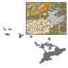
|
| Southern Ontario Land Resource Information System (SOLRIS) | Ontario Ministry of Natural Resources | 2000 - 2002 | 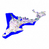
|
| Surficial Geology of Southern Ontario - Line Representation | Ontario Ministry of Northern Development, Mines and Forestry | 2003 - 2010 | 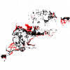
|
| Surficial Geology of Southern Ontario - Miscellaneous | Ontario Ministry of Northern Development, Mines and Forestry | 2003 - 2010 | 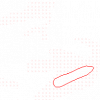
|
| Surficial Geology of Southern Ontario - Moraines | Ontario Ministry of Northern Development, Mines and Forestry | 2003 - 2010 | 
|
| Surficial Geology of Southern Ontario - Point Representation | Ontario Ministry of Northern Development, Mines and Forestry | 2003 - 2010 | 
|
| Surficial Geology of Southern Ontario - Polygon Representation | Ontario Ministry of Northern Development, Mines and Forestry | 2003 - 2010 | 
|
| Surficial Materials of Canada Map - 1880A | Natural Resources Canada |
1995 | 
|
| Tectonic Assemblages of Ontario | Ontario Geological Survey |
1993 | |
| The National Map | U.S. Department of the Interior, U.S. Geological Survey (USGS) |
Various | |
| Unified Geologic Map of the Moon, 1:5M, 2020 | U. S. Geological Survey | 2020 | |
| Yukon Digital Geology | Geological Survey of Canada |
2003 |