Revision Note: Please note that this dataset has been revised and is available from the Land Information Ontario (LIO) Warehouse.
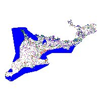
SOLRIS is a primary data layer that provides a comprehensive, standardized, landscape level inventory of natural, rural and urban lands in Ecoregions 6E and 7E, current to 2000-2002. It is based on MNR's Ecological Land Classification (ELC) for southern Ontario (Lee et al, 1998).
Release Notes: The initial release of SOLRIS (Version 1.1 - November, 2006) is restricted to a geographic area generally constrained by the Greater Toronto Area. The current release of SOLRIS (Version 1.2 - April, 2008) covers Ecoregions 6E and 7E in entirety, but unlike Version 1.1, does not provide a classification of agricultural land use.
Additional Time Period Information: The time period reflects the date range of the source data used to produce the SOLRIS product.
Access this resource on Scholars Geoportal.
Access this resource on Scholars Geoportal.
