Breadcrumb
Geospatial Data
| Title Sort descending | Author | Year | Sample |
|---|---|---|---|
| Erkelenz, Germany. 1:25,000. Map Sheet 4903, Going Map, 1944 | Great Britain. War Office. General Staff. Geographical Section. | 1944 | 
|
| Esri Canada Health GIS Hub | Esri Canada | ||
| ESRI Great Lakes Bathymetry Contours | National Oceanic and Atmospheric Administration (NOAA) | 2013 | 
|
| European Soil Database and Soil Properties | European Commission, Joint Research Centre, European Soil Data Centre (ESDAC) |
Various | |
| Exit Points (XIT) | DMTI Spatial Inc. | 2001 - 2014 | 
|
| Expressway Casements (EXC) | DMTI Spatial Inc. | 2001 - 2014 | 
|
| Falaise, France. 1:25,000. Map Sheet 40/12 N.W., Defence Overprint, Operation Totalize, 6 August 1944 | Great Britain. War Office. General Staff. Geographical Section. | 1944 | 
|
| Family Health Teams | Ontario Ministry of Health and Long-Term Care | 2011 | 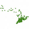
|
| Far North Land Cover | Ontario Ministry of Natural Resources | 2009 - 2012 | 
|
| Federal Electoral Districts - Digital Boundary File (FED-DBF), 2014 (2013 Representation Order) | Elections Canada | 2014 | 
|
| Federal Electoral Districts and Polling Division Boundaries | Elections Canada |
Various, between 2000 and 2021 | 
|
| Federal Land Other | Ontario Ministry of Natural Resources | 2011 | 
|
| Federal Protected Area | Ontario Ministry of Natural Resources | 2008 | 
|
| Feeding Area, Fish | Ontario Ministry of Natural Resources | 1997 - 2005 | 
|
| Feeding Area, Wildlife | Ontario Ministry of Natural Resources | 1997 - 2005 | 
|
| Ferry Connections Line | DMTI Spatial Inc. | 2015 - 2023 | 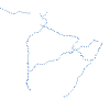
|
| Fichier du réseau routier (FRR) (Intercensitaires) | Statistique Canada | 2005 - 2022 | |
| Fichier du réseau routier (FRR), Année de recensement 2011 | Statistique Canada | 2011 | 
|
| Fichier du réseau routier (FRR), Année de recensement 2016 | Statistique Canada | 2017 | 
|
| Fichier du réseau routier (FRR), Année de recensement 2021 | Statistique Canada | 2022 | 
|
