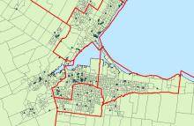
The Federal Electoral Districts and Polling Divisions are respresented as polygons, but there is a second Polling Division shapefile that is in point format. This shapefile describes mobile polls, and single building polling divisions such as large apartment buildings.
Please note that these are boundary files ONLY, and therefore do not contain any political results. Poll-By-Poll results matching these boundary files are also available through the same link. The results are provided in .csv format, and may require editing prior to being able to use in GIS software.
Federal Electoral Districts and Polling Division boundaries are available for download through the Open Government Portal.
Federal Electoral Districts are available for download through Scholars GeoPortal as part of the Census geography files. This dataset does not include polling divisions.
