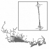
| Highways (HWY) |
DMTI Spatial Inc. |
2001 - 2014 |
|
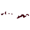
| Highways Exits Point |
DMTI Spatial Inc. |
2015 - 2023 |
|
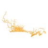
| Highways Line |
DMTI Spatial Inc. |
2015 - 2023 |
|
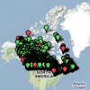
| HYDAT Database - Canada |
Environment Canada |
2013 |
|
| Hydro Junctions Point |
DMTI Spatial Inc. |
2015 - 2023 |
|
| Hydrographic Structures - Lines (HSL) |
DMTI Spatial Inc. |
2001 - 2014 |

|
| Hydrographic Structures - Points (HSP) |
DMTI Spatial Inc. |
2001 - 2014 |
|
| Hydrographic Structures - Regions (HSR) |
DMTI Spatial Inc. |
2001 - 2014 |
|
| Hydrography - Lines (HYL) |
DMTI Spatial Inc. |
2001 - 2014 |
|
| Hydrography - Points (HYP) |
DMTI Spatial Inc. |
2001 - 2014 |

|
| Hydrography - Regions (HYR) |
DMTI Spatial Inc. |
2001 - 2014 |

|
| Ice Roads Line |
DMTI Spatial Inc. |
2018 - 2023 |
|
| Îlot de diffusion - Fichiers numériques des limites, Année de recensement 2006 |
Statistique Canada |
2007 |

|
| Indigenous Services Canada Map Room |
Indigenous Services Canada |
Varies |
|
| Industrial and Resource - Lines (IRL) |
DMTI Spatial Inc. |
2001 - 2014 |
|
| Industrial and Resource - Points (IRP) |
DMTI Spatial Inc. |
2001 - 2014 |

|
| Industrial and Resource - Regions (IRR) |
DMTI Spatial Inc. |
2001 - 2014 |
|
| Intermittent Water (MNINR) |
DMTI Spatial Inc. |
2005 - 2014 |

|
| International Road Linkages Point |
DMTI Spatial Inc. |
2015 - 2023 |
|
| Land Cover Region |
DMTI Spatial Inc. |
2015 - 2023 |
|