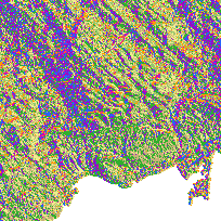
The Enhanced Flow Direction Grid is a grid representing surface flow directions derived from Version 2.0 Digital Elevation Model (DEM) with the added enhancement of having the photogrammetrically mapped hydrology (WRIP Water Virtual Flow and NRVIS water body segment) embedded within the grid so that known hydrology is accurately represented within the grid.
Also included in version 2 is an alternative assignment of flow direction to shoreline areas. The inclusion has the following effects: Brings the limit of the Flow Direction grid closer to the shoreline resulting in a cleaner product; Allows for the delineation of distinct shoreline catchments not possible in the previous EFD product; Minimizes effects of shoreline bleeding (erroneous catchments being formed in -no-data- areas usually upstream of project areas); and Assigns proper flow directions to minor bays and inlets.
To cover Ontario the grid has been divided into 16 pieces, existing in their respective UTM zones 15, 16, 17, and 18. Each grid covers major watersheds within these zones. The naming conventions of the grid follow the naming conventions of the Secondary and Tertiary Provincial watershed layers. The resolution of the Enhanced Flow Direction Grid is the same as the Provincial Digital Elevation Model - 10m for southern Ontario (where 1:10,000 base data exists) and 20m for Northern Ontario (where 1:20,000 base data exists). Currently, 16 of the 16 grids covering Ontario are included in the package. There are index shapefiles included within the package to show the extent of each grid.
Access this resource on Scholars Geoportal.
Access this resource on Scholars Geoportal.
