Revision Note: Please note that this dataset has been revised and is available from the Land Information Ontario (LIO) Warehouse.
Various systems exist to delineate natural regions based on ecological factors. The Ministry of Natural Resources (MNR) defines ecological units on the basis of bedrock, climate, physiography and corresponding vegetation, creating an Ecological Land Classification system.
The ELC of Ontario was revised by the ELC Working Group in 2000 to better reflect the ELC system originally developed by Angus Hills (1959 and later revisions). This dataset was revised to take account new information and new technology, while maintaining Hills's original concepts. For further information on the rationale for the revisions, refer to 'Ecoregions of Ontario: Modifications to Angus Hills- Site Regions and Districts, Revisions and Rationale, Crins and Uhlig 2000'. In 2002, the spatial data was updated using NRVIS drainage polygon data including islands from Great Lakes, St. Lawrence, and Ottawa River, and more detailed shoreline data. NTS mapping was also used to delineate the northern, eastern (Quebec border), and western (Manitoba border) boundaries of the province.
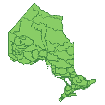
This packaged dataset is classified into three hierarchical categories: Ecozones, Ecoregions, and Ecodistricts.
Access this resource on Scholars Geoportal.
Access this resource on Scholars Geoportal.