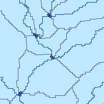
Arc Hydro (AH) is a geospatial and temporal data model for water resources, which operates within ArcGIS and was developed by the GIS in Water Resources (GISWR) Consortium in the United States. The Consortium is comprised of several members including:
AH consists of a set of tools used to create and support a comprehensive water resources framework for hydrologic and related geospatial data analysis. The original focus of Arc Hydro was to support surface water modeling, but work has progressed into the groundwater realm. ESRI plans to link the two systems into one complete data modeling framework in the near future.
The Ministry of Natural Resources - Water Resources Information Program (WRIP) was involved in a multi-year project to develop standardized Arc Hydro surface water data sessions based on the Quaternary Watershed fabric for the Province of Ontario. Each session contains foundation layers required for fundamental hydrologic watershed analysis.
To meet the requirements of Arc Hydro, the project team followed rigorous quality checking and assurance procedures which resulted in extensive and significant base data improvements across the Province. These enhancements are regarded collectively as a 'snapshot' version of our hydrology base and derivative products. Base data updates are happening on a continual basis, which will have implications on any derivative or related product that has been produced to date by the Province. Any further work in Arc Hydro will depend on available resources and support from the various business areas interested in utilizing these data and tools.
Some key elements of the project include:
Access this resource on Scholars Geoportal.
Access this resource on Scholars Geoportal.
