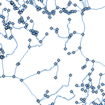
Aquatic Landscape Inventory System (ALIS) was developed to automate the process for delineating, characterizing and classifying of valley segments within Great Lakes Basin watersheds. ALIS delineates streams based on a number of different natural features. This application has been applied on the Ontario side of the Great Lakes to identify continuous valley segments and has been used to attribute landscape attributes for sites where fish and habitat data are available.
The ALIS database is made up of two components: an application and a data component. The GIS application will offer users a tool to extract data, summarize and report results and classify, categorize, etc. the data collected through ALIS. The second component is strictly a Microsoft Access 2002 database containing the data. The GIS application component links to the data component, this allows for central control over the master attribute data. In order to run ALIS, the user must be running a licensed version of ArcGIS 8.1. or later. In addition, the user will also need a copy of Microsoft Access 2002 to store the data. Once the data has been collected, users with a copy of Microsoft Access 2000 will be able to work with the attribute data stored in the ALIS database independent of the GIS application.
Access this resource on Scholars Geoportal.
Access this resource on Scholars Geoportal.
