Geospatial Data
| Title Sort descending | Author | Year | Sample |
|---|---|---|---|
| Snowshed Line | DMTI Spatial Inc. | 2015 - 2023 | 
|
| Socioeconomic Data and Applications Center (SEDAC) Datasets | NASA Socioeconomic Data and Applications Center (SEDAC) |
Various, 1970 to Present | |
| Soil and Terrain Database for Central Africa (SOTERCAF) | United Nations Food and Agriculture Organization (FAO) and International Soil Reference and Information Centre (ISRIC) |
2006 | |
| Soil Degradation and Vulnerability Assessment for Central and Eastern Europe (SOVEUR) | United Nations Food and Agriculture Organization (FAO) and International Soil Reference and Information Centre (ISRIC) |
2000 | |
| SOLRIS 3.0 | Ontario Ministry of Natural Resources | 2000-2015 | |
| Stadium Point | DMTI Spatial Inc. | 2015 - 2023 | 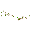
|
| Stationary Cranes Point | DMTI Spatial Inc. | 2015 - 2023 | 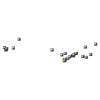
|
| Tactical Pilotage Charts (TPC) | LAND INFO Worldwide Mapping, LLC |
1989 | |
| The City of London's Open Data Catalogue | City of London, Ontario |
Varies by dataset | 
|
| The European Forest Fire Information System (EFFIS) | European Commission Joint Research Centre |
2003-Current | 
|
| The National Map | U.S. Department of the Interior, U.S. Geological Survey (USGS) |
Various | |
| Toronto Fire Insurance Plans | Charles E. Goad |
1884 - 1910 | |
| Toronto Homicide Data, 1990-2014 | Toronto Star | 2015 | 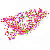
|
| Tourist Attractions Point | DMTI Spatial Inc. | 2015 - 2023 | 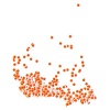
|
| Tower | Ontario Ministry of Natural Resources | 1977 - 2009 | 
|
| Traditional Land Use Area | Ontario Ministry of Natural Resources | 1997 - 2005 | 
|
| University of Toronto Daniels Faculty Lidar | Sky Analytics Inc. | 2021 | |
| Valves Point | DMTI Spatial Inc. | 2015 - 2023 | 
|
| Vector Map Level 0 (VMap0) | LAND INFO Worldwide Mapping, LLC |
2000 | |
| Veterinarians Point | DMTI Spatial Inc. | 2015 - 2023 | 
|
