| Soil Survey Complex |
Ontario Ministry of Agriculture, Food, and Rural Affairs |
1929 - 2003 |
|
| Waterloo Region Historic Air Photo Collection |
Unknown |
1930, 1945-47, 1955, 1963 and 1966 |
|
| 1934 Air Photos of Niagara Region |
Canada Department of Energy, Mines, and Resources |
1934 - 2017 |
|
| Assessment File Research Image (AFRI) Database |
Ontario Ministry of Northern Development and Mines |
1940 - 2009 |
|
| Historic Bathymetry Maps |
Ontario Ministry of Na |
1940-1990 |
|
| Canadian Climate Normals and Averages |
Environment and Climate Change Canada |
1941 - 2020 |
|
| Berneval, France. 1:12,500. Map Sheet, Home Forces 23, 3rd Edition, June 1942 |
Great Britain. War Office. GHQ Home Forces |
1942 |
|
| Designated Gas Storage Area |
Ontario Ministry of Natural Resources |
1942 - 2003 |

|
| Port of Rouen, France. 1:15,000. Map Sheet CB 4096 J, GSGS Misc. 68, March 1943 |
Great Britain. War Office. Inter-Service Topographical Department |
1943 |

|
| Versen, Germany. 1:25,000. Map Sheet 4704, Going Map, 1944 |
Great Britain. War Office. General Staff. Geographical Section. |
1944 |
|
| Casteldelci, Italy. 1:25,000. Map Sheet 108 III N.E., 1st Edition, Defence Overprint, 12 August 1944 |
Great Britain. War Office. General Staff. Geographical Section. |
1944 |
|
| Blitterswijk, Eastern Holland. 1:25,000. Map Sheet 4402, 3rd Edition, Engineer Overprint, December 1944 |
United States. Army Map Service |
1944 |
|
| Erkelenz, Germany. 1:25,000. Map Sheet 4903, Going Map, 1944 |
Great Britain. War Office. General Staff. Geographical Section. |
1944 |
|
| Tegelen, Eastern Holland. 1:25,000. Map Sheet 4602, Going Map, 1944 |
United States. Army Map Service |
1944 |
|
| Emmerich, Eastern Holland. 1:25,000. Map Sheet 4103, 3rd Edition, Defence Overprint, December 1944 |
Canada. Royal Canadian Engineers |
1944 |
|
| Goch, Eastern Holland. 1:25,000. Map Sheet 4302, 3rd Edition, December 1944 |
United States. Army Map Service |
1944 |
|
| Issum, Germany. 1:25,000. Map Sheet 4404, 2nd Edition, Defence Overprint, 18 December 1944, Version 1 |
Great Britain. War Office. General Staff. Geographical Section. |
1944 |
|
| Caen, France. 1:25,000. Map Sheet 40/16 S.W., Defence Overprint, May 1944 |
Great Britain. War Office. General Staff. Geographical Section. |
1944 |

|
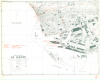
| Le Havre, France (SW). 1:10,000. Map Sheet 2, 2nd Edition, Town Plan, Defence Overprint, 5 September 1944 |
Great Britain. War Office. General Staff. Geographical Section. |
1944 |
|
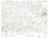
| Falaise, France. 1:25,000. Map Sheet 40/12 N.W., Defence Overprint, Operation Totalize, 6 August 1944 |
Great Britain. War Office. General Staff. Geographical Section. |
1944 |
|