Year
1943
Abstract
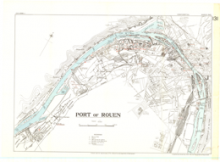
This is a 1:15,000 scale map of the Port of Rouen, France. It was published in March 1943 by the Inter-Service Topographical Department of the War office of Great Britain, under the superintendence of Vice-Admiral Sir John Edgell, KBE CB, Hydrographer.
This map is GSGS Miscellaneous (Misc) Map 68.
URL
Access this resource on Scholars Geoportal.
SGP_id
WWIIMMPortofRouen_1943_TIFF
Scholars Geoportal URL
Access this resource on Scholars Geoportal.