Geospatial Data
| Title Sort descending | Author | Year | Sample |
|---|---|---|---|
| Oak Ridges Moraine - Rare, Threatened & Endangered (RTE) Species Occurrences Generalized | Ontario Ministry of Natural Resources | 1998 - 2002 | 
|
| Oak Ridges Moraine - Sand Barrens, Savannahs, Tallgrass Prairies | Ontario Ministry of Natural Resources | 1998 - 2002 | 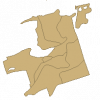
|
| Oak Ridges Moraine - Subwatersheds (Points) | Ontario Ministry of Natural Resources | 2003 | 
|
| Oak Ridges Moraine - Subwatersheds (Polygons) | Ontario Ministry of Natural Resources | 2003 | 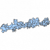
|
| Oak Ridges Moraine Conservation Plan Datasets | Ontario Ministry of Natural Resources |
1983 - 2006 | |
| Ontario GeoHub | Ontario Ministry of Natural Resources |
Varies by dataset | |
| Ontario Trail Network | Ontario Ministry of Natural Resources | 2008 - 2010 | 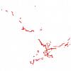
|
| Open Hamilton | City of Hamilton | Varies by dataset | |
| Ottawa Vector Data Set | City of Ottawa |
2007 | 
|
| Parks and Recreation - Lines (PRL) | DMTI Spatial Inc. | 2001 - 2014 | 
|
| Parks and Recreation - Points (PRP) | DMTI Spatial Inc. | 2001 - 2014 | 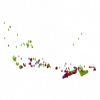
|
| Parks and Recreation - Regions (PRR) | DMTI Spatial Inc. | 2001 - 2014 | 
|
| Peatlands of Canada | Natural Resources Canada |
2011 | |
| Polar Data Catalogue | Canadian Cyrospheric Information Network (CCIN) |
Varies by dataset | |
| Predicted Species Distributions and Vegetation Assemblages for Eco-district 6e10 | Ontario Ministry of Natural Resources | 2005 - 2008 | |
| Prince Edward Island GIS Data Catalog | The Government of Prince Edward Island |
Current, some historical | |
| Provincial Park Regulated | Ontario Ministry of Natural Resources | 1893 - 2008 | 
|
| Provincial Satellite Derived Disturbance Mapping | Ontario Ministry of Natural Resources | 2010 - 2012 | 
|
| PurpleAir | Purple Air, Inc. | Various | |
| Resting Area | Ontario Ministry of Natural Resources | 1998 - 2004 | 
|
