Geospatial Data
| Title Sort descending | Author | Year | Sample |
|---|---|---|---|
| Habitat Planning Range | Ontario Ministry of Natural Resources | 1998 - 2008 | 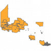
|
| Haliburton County Enhanced Wetland Mapping | Ducks Unlimited Canada | 1998 - 2003 | 
|
| Health Integration Networks | Ontario Ministry of Health and Long-Term Care | 2011 | 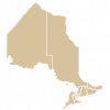
|
| Health Regions | Statistics Canada |
2003-2023 | |
| Historic Bathymetry Maps | Ontario Ministry of Na | 1940-1990 | |
| Historic Ontario Road Network (ORN) Address, 2010 | Ontario Ministry of Natural Resources | 2010 | 
|
| Historic Ontario Road Network (ORN) Address, pre 2007 | Ontario Ministry of Natural Resources | 2007 | 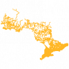
|
| Historic Ontario Road Network (ORN) Road Net Element, 2008 | Ontario Ministry of Natural Resources | 2008 | 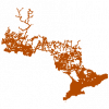
|
| Historic Ontario Road Network (ORN) Road Net Element, 2009 | Ontario Ministry of Natural Resources | 2009 | 
|
| Historic Ontario Road Network (ORN) Segment Address, 2007 | Ontario Ministry of Natural Resources | 2007 | 
|
| Historic Ontario Road Network (ORN) Segment Address, 2009 | Ontario Ministry of Natural Resources | 2009 | 
|
| Historical Topographic Maps 1:25,000 Index | Surveys and Mapping Branch, Department of Energy, Mines and Resources | 1956 - 2016 | |
| Historical Topographic Maps: 1:50,000 Index | National Resources Canada (NRCan) / Ministère des Ressources naturelles Canada (RNCan) | 1950 - 2020 | |
| Historical Topographic Maps: 1:63,360 Index | Geographical Section, Department of National Defence | 1906 - 2016 | |
| HIV/AIDS Health and Information Services Locations | Ontario Ministry of Health and Long-Term Care | 2014 | 
|
| Hospital Locations | Ontario Ministry of Health and Long-Term Care | 2011 | 
|
| HYDAT Flow Gauge Watersheds - Ontario REPLACED | Ontario Ministry of Natural Resources | 2003 - 2015 | 
|
| Indian Reserve | Ontario Ministry of Natural Resources | 1800 - 2008 | 
|
| Kingston Civic Addresses | City of Kingston | 2021 | 
|
| Kingston Road Segments | City of Kingston | 2021 | 
|
